Friday, December 28, 2012

California Christmas

Our campsite at the East Shore RV Park
We arrive in California a few days before Christmas.  After frugally searching for a free camping spot in the Angeles National Forest, we learn from a park ranger that it's not safe to leave our trailer alone on public land in the foothills, so we go to an RV park instead.  And it's a gorgeous RV park - the East Shore RV Park in the Frank G. Bonelli Regional Park on the Puddingstone Reservoir in San Dimas (next door to Pomona, home of the Fairplex and popular drag car racing park which we can see from our site.)  We are camped high up on a hill overlooking part of the reservoir, a small airstrip, multi-million dollar homes and the snow-capped mountains to the east.  It's a beautiful view, as it should be for almost $60/night!  Since it's been raining almost every 3 or 4 days, the grass is green and lush which Grady loves after the dry, sandy desert.

Uncle Bill, Marilyn & Brad Christmas Day 2012
We wouldn't normally pay this much money to camp, but we are here to spend Christmas with my 83-year old uncle, my dad's last surviving sibling.  Uncle Bill reminds me a lot of my dad, and I get him talking about their childhood.  They were very close and spent a lot of time together when young, being only 2 years apart in age.  It is interesting to hear stories about my dad, their other 2 brothers and my grandparents, like how my grandmother was a crane operator at one of the steel plants in Hamilton during the depression and she had to tie her dress together at her knees so the male workers wouldn't look up her skirt!  We enjoy a wonderful family visit, go out for a few meals, and we cook him a small Christmas dinner. 

Reservoir, big homes and foothills beyond
During our stay here, our truck dies.  We are leaving to go pick up my uncle to go grocery shopping then out to dinner when the truck starts, then stalls and won't restart.  Luckily, this year we had purchased Roadside Assistance for our truck AND trailer, so we get a free tow to a nearby GM dealer, although it's late Saturday afternoon and no mechanics are on duty until Monday morning.  So Brad and I wait it out at the RV park (grateful the trailer was already parked somewhere) and use the time to walk along the reservoir and relax.  Monday morning (Christmas Eve day), the truck gets fixed (a cracked housing over the fuel pump which leaked diesel) and the best part is it's covered by our warranty.  Merry Christmas to us.

After almost a week, we are sad to leave but looking forward to continuing our desert camping experience.

Thursday, December 20, 2012

A Day in the Life Of...

Finally - we arrive in the land of palm trees and cacti.  Brad has ordered some LED bulbs to replace those in our trailer and we pick them up at an RV dealer in Phoenix.  He has ordered only two to test to ensure they are bright enough, which they are, so we order the rest.  Now we have to wait over the weekend for the second order to arrive.

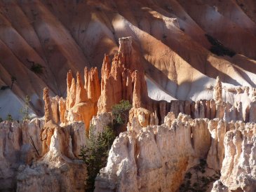
Campsite on Vulture Peak Road, Wickenburg, AZ
As readers of my blog, you know we like to camp for free and not in an RV park, and there are not a lot of free opportunities near Phoenix, but we do find a place in the "mountains" 1/2 hour away near Wickenburg.  It's a beautiful area with jagged peaks just over 3,000 feet, and a variety of cactus and small trees surrounding dispersed camping sites on BLM land.  Unfortunately, it's a rainy weekend so we catch up on indoor stuff.

Since I have nothing else to write about, I thought I would describe what it's like to "boondock" or dry camp - live in our trailer without hookups provided in RV parks.  We do it because we enjoy being in remote areas without neighbours even though there are limitations.  When we started out in our first year, we weren't fully equipped to dry camp, but we've since upgraded everything and the LED lights are the last step in the process.  Of course, Brad's always finding new toys from other RVers.  So, here's a day in the life of Brad and Marilyn ...

Today is moving day.  Grady hates it.  After we do our usual morning routine of coffee, one episode of the Red Green Show (which we record daily, can you believe it!), breakfast and personal grooming, we pack up the trailer.  Brad does the outside jobs (putting down the solar panels, hooking up the truck, lifting the landing gear), I do the inside jobs (packing away loose items, repositioning furniture to allow us to slide in the sides, locking down and closing all doors and cupboards, pushing the magic buttons that close the three slide-outs).  Time to pack up the trailer - up to 30 minutes although we can do it in about 10 minutes if we have to.

Our first stop is to dump our used water and fill with fresh water.  Our trailer is equipped with an 85 gallon fresh water tank which will last us about 8 days (we use this water for drinking as well as washing dishes and ourselves).  Our two grey water tanks are 35 gallons each and the black water tank is, I think 20 or 30 gallons.  When we arrive at a new location, we investigate where to dump and fill.  Because RVing seems to be so common in the areas where we travel, it is not as difficult as you might think to find water.  Many gas stations provide these services, some for free, others for about $5.  Many RV parks and state or federal campgrounds allow us to dump and fill for a small fee.  When we are boondocking, we are very conservative with our water, to the point of using paper plates and bowls which can be burned in campfires.  Time spent to dump and fill - about 30 minutes.

Disposing of garbage is typically the most problematic issue.  BLM land (federally-owned land for recreational use by the general public) typically does not have a garbage bin.  They have a "carry in/carry out" policy.  Some BLM field offices have given us permission to use their bins behind the office, gas stations occasionally give us permission, or we wait until we get to a developed campground.

Next stop is to fuel:  diesel for the truck, gas for the generator, propane for appliances (fridge, stove, hot water heater and 20,000 BTU portable propane heater).  Let me rant for a moment - when you're pulling a 35-foot fifth-wheel trailer that requires a large turning radius and wide laneways, you can't drive around a gas station looking for the diesel pump.  99.9% of all gas stations we have been to do NOT make the diesel pump obvious, and I often have to get out of the truck at the gas station street entrance and walk around the pumps to find the green handle which signifies diesel then Brad has to figure out how to get in and out of that pump.  You would think it would be easy, but it isn't always.  Interstate gas stations are better than those in cities; but we usually travel on small state highways using the Interstates only for our trip to our first destination and our trip home.  We also have to find propane stations which will fill tanks (not a tank exchange).  A lot of gas stations provide this service, but a trained staffer must be available to pump it.  Time at the gas station - up to 30 minutes.

Next stop is food.  We usually grocery shop on moving day.  After we purchase the food, we have to open part of the trailer (open the kitchen slideout) and put the groceries away.  Time spent grocery shopping and putting everything away - about 1 hour.

When we get to or near our next destination, we always stop at the local BLM office or Visitor Center to investigate campsites and hiking spots.  It's here we also find out where to get fresh water and dump our dirty water, and where to get propane.  Sometimes we also have to ask where to grocery shop as we are often in very remote, rural areas and we may have to drive to another town.  Time at a Visitor Center - 30 minutes to one hour.

Now we are finally ready to find our campsite.  Our GPS is usually useless when locating a free campsite, so I use a combination of sources - the internet, Frugal RV Travel Guides which I have purchased and which are an excellent source of information, BLM offices and Visitor Centers, and Benchmark map books which where public land is.  Finding a dispersed campsite on public land is not always easy.  Usually, they can be identified by a disturbed area with a fire ring indicating that someone has previously camped here.  BLM staff ask that you camp in a site that has previously been used to limit the impact to an area.  Time to find a campsite - anywhere from 10 minutes to 1 hour.

Once we have found that perfect campsite, we open up the trailer - Brad does the outside jobs and I do the inside jobs.  This takes about 30 minutes.

Excluding travel time, moving day activites consume 3 to 4 hours.  Movings days are long, and at every stop Grady is hopeful that it's the last one.  He's a very patient cat.  He much prefers non-moving days, when he plays in the morning, eats, sleeps, plays in the evening, eats and sleeps.  Well, who knows what Grady does when Brad and I are out hiking all day, but that's what he does on days we hang around the trailer.

When we boondock or dry camp, main considerations are power and water.  We are not tenters, so we need power.  We have two solar panel to produce power which is stored in our two large 6V batteries with 325 Amp Hours each, and an inverter that converts the DC power from the batteries into the AC power used in electrical outlets.  We also have a super-quiet 5,500 watt generator which we used for power-hungry appliances like the microwave/oven and my hair blower (c'mon, I still have to look good!), and to charge the batteries on the rare cloudy day.  Not only do we angle the trailer so that our big back window faces east to capture the morning sun for early radiant heating (Grady's cat tower is in the back window and he waits for that sun every morning) and our numerous living room windows face south to capture the afternoon sun, Brad also lifts the solar panels so they absorb the low, winter rays of the sun.  This specific trailer angle is another reason we like to boondock; in an RV park you have to park your trailer on a gravel or asphalt pad that may not suit our solar needs.  On a really sunny day, we can make up to 160 amp hours (that's a lot).

Heat is provided by a 20,000 BTU portable propane heater which we purchased during our first year after our furnace drained our old RV batteries overnight.  We typically use the heater only during the night and only cool, rainy days like today.  The trailer has an air conditioner, but we have rarely used it.  Because we travel in the winter, it is usually not too hot even in the southwest.  We also can't use it without electrical hookup (30 or 50 amp as provided at an RV park) as it draws too much power even for our generator.  We have only wanted to use it once during a heat wave in Big Bend National Park in southern Texas in February 2011, but we survived without it.

We are connected to the outside world via a satellite dish (for TV) and cell phones.  We always look for wide, open spaces in which to park the trailer for our satellite dish and solar panels, both of which need a clear sky view to the south.  We use our home satellite plan for our trailer.  Our cell phones are both American:  we have a TracFone for making and receiving calls (pay-as-you-go minutes) and a Palm Pixie with a cheap plan from Verizon for our internet signal.  We can also use our Verizon phone for calls, but at a much more expensive rate than the TracFone.  Of course, we need a cell tower in the vicinity for the phones to work, and coverage can be sparse especially in Utah and Arizona.  It is not unusual for us to drive into town to pick up milk and to take our cell phone and computer with us to download email or use the internet.

So it's cetainly a different lifestyle.  RVing and specifically boondocking has made me very aware of how much electricity and water each person consumes.  When I go back home and I run the kitchen tap just so the water gets hot so I can rinse or soak a pan, I am reminded of how I would NEVER do that in my trailer.  That pan would be wiped out with a paper towel until it's almost clean, then I would quickly wash it with soap and water trickling.  Too much effort?  Perhaps, but you do what you have to do.  And it's not that difficult once it becomes your norm.

For me, I love boondocking and RVing - I get to go some really beautiful places.  But I also love my time at home.  I am grateful to have the best of both (of my) worlds.

Friday, December 14, 2012

Lee's Ferry, Arizona

During our trip to Arizona four years ago, we drove out of our way 30 extra miles to Lee's Ferry to see the Colorado River up close and personal.  Lee's Ferry, officially part of the Glen Canyon National Recreation Area and Grand Canyon National Park, and bordered by the Vermilion Cliffs National Monument, is THE launch site for river rafters.  It was mid-October then and the water at the small, sandy beach area was so cold, it numbed our feet and ankles within seconds; but there were kids swimming - of course they were!  We didn't spend much time here because we were on our way to Page for an overnighter.  This time, we want to see some of what the river and canyon has to offer.

Campsite with river below
There is a campground on a hill overlooking the river rapids; surrounding our trailer are bright red/orange cliffs about 1,700 feet high.  Only 15 miles downstream, the gorge becomes the infamous Grand Canyon, so you can picture what we see.  Lee's Ferry is, reportedly, the only place within 70 miles to get down to the river.  The colour (green) and power of the water are reminiscent of the mighty Niagara River.  The sound of the rapids lull us to sleep at night.  The water level is fairly high (even though Lake Powell upstream is so low!) and the beach we walked on four years ago is now under the current.

The name, Lee's Ferry, originated from the man who started the first (and only) ferry service here - John D. Lee, a Mormon settler.  River crossings were more common then as other Mormon settlers used the service in their pioneering during the late 1800s.  A small settlement grew here and there are several sandstone buildings as evidence of the lives that once called this magnificent place home.  Gold mining was also attempted here, but the technology did not exist to extract the fine, powdery metal from the abundant clay.  A short, interpretive trail follows the river for about 1/2 a mile, exhibiting the old buildings and mining boilers.  The Spencer Trail climbs to the top of one of the cliffs for a view of the gorge, but at 1,700 feet up, we take a pass!

Marilyn climbing down around various dryfalls
We do, however, hike the Cathedral Wash.  This is a short 1.5 mile trail that leads down the wash to the Colorado River.  At first, the hike is less than interesting, although the hardened clay/sand walls contain many fossils from ancient seabeds that once covered this area; in fact, much of the rock resembles a huge sea sponge.  And suddenly, we come to a 25-foot drop - a waterfall, now dry awaiting spring snowmelts.  There is no mention of this in our photography book which has guided many of our hikes on this trip; nor in the Glen Canyon brochure - we are supposed to be able to get to the river.  Upon closer inspection, we spy a way to climb down on the side wall (hope we can get back up!).  This is not our last dryfall we must circumnavigate, but it is the highest in this canyon, which has narrowed to a very pretty slot canyon with 1,500-foot high red cliff walls.  Then we can hear the rushing water of the Colorado River, and our trail ends at a beautiful, sandy little beach.  What a pleasant surprise!
Brad (bottom left) standing in Cathedral Wash

Picnic lunch at the Colorado River
Notice how much higher the water is behind us above the rapids
The sand is soft, there are huge boulders that have been pushed down Cathedral Wash during floods (flash floods are VERY common in the desert, but happen mostly in the summer and early fall after thunderstorms which may occur many miles away), trees and bushes.  There are animal tracks all over in the sand, probably small rodents.  We have lunch on the beach and notice that, looking up-river, we can easily see that the height of the water is some two feet above where we are standing.  It's a bit disorienting as you expect a river to at least look level even though you know it's flowing downhill.  But such a drop I haven't seen except in the Niagara Gorge where we hike down from the Niagara Glen picnic area near the Whirlpool.  The river here is only about 50 or 60 feet across and flowing incredibly fast.  It's a great spot for our picnic lunch, at least until the sun goes behind the cliff wall and we are reminded that it's the middle of December and only in the mid-40s (temperature, maybe 6C)!  Our hike back is much easier now that we know the route (getting around the dryfalls).  Another canyon hike survived.
Making our way back up the 25-foot dryfall (seen on right)

Beach Camping, Utah/Arizona

(First, I must admit to being lazy.  I should have written this blog almost a week ago when it all happened.  Anyway, better late than never...)

Camped at Lone Rock Beach, Lake Powell
Our next stop is Page, Arizona, only a few miles from the Utah border and about one hour from Kanab (our previous stay).  We camp right on the shores of Lake Powell just 7 miles northwest of Page inside the Utah border.  It has been 4 years since we were last in Page, and at that time we never made it to the lake (we also didn't have the trailer then), so this time it's a must.  We are the only ones camping here besides the campground host (this is an official primitive [no services] campground of the Glen Canyon National Recreation Area and a small nightly fee is charged), but we have the entire beach to ourselves.  Last time we were in this area, we visited Antelope Canyon, a brilliant slot canyon with hues of orange, yellow, purple and white depending on the light rays penetrating into the canyon, and Horseshoe Bend overlooking the Colorado River some 2,000 feet below cliffs that would excite the Wallendas - and Brad who sat on the edge of the abyss... we will forego these sites on this trip.  We pass most days here this year chilling out on our beach chairs.  It's just too peaceful here to go anywhere, and with views of the Vermilion Cliffs, the deep blue lake and Navajo Mountain in the distance, what more could we want?  Lone Rock sits several hundred yards out front of us.  We can see how low the water level is (about 87 feet below "full pool" or 54% full) by the bleaching on the bottom of the rock walls all around the lake.  Many marinas are closed because they are unusable.  Wahweap Marina, a few miles east of us, is still open and full of beautiful boats.
Campfire on the beach, Lake Powell

Wahweap Marina, Lake Powell
Grady and Marilyn walking on the beach at Lake Powell
 We expect Grady will love going for walks here because of the sand and wide open spaces, but the opposite proves true.  The sand is wet and hard in most places because of the cold, damp nights, so he doesn't roll around in it much like he did the soft, red sands of the dry creek beds in Utah.  He also seems afraid of the lake, which he won't go near.  He's very interested in the coots swimming there, but only as a cat watching birds.  And the ravens - these really frighten poor Grady because they start to attack him from the air.  They swoop at him, looking like they will pick him up in their talons.  I have to hover over the poor kitty to keep him safe.  I didn't think these scavenger birds actually hunt, but I guess they will - or perhaps they are trying to scare him away from their territory.  But Grady's last straw is the Russian Thistle (tumbleweed) bushes that forest a soft sandy area between the NRA road and the lake.  This plant, found throughout the desert regions of the southwest, are vicious, at least this time of year when they are dried up and consisting of only tiny pea-size spheres coated with tiny thorns that stick to everything including the rubber soles of our shoes.  And they hurt.  So here's the story...

Carrying Grady in my sweater (thistles in background)
It's our first day at Lone Rock Beach and we take Grady out for a walk.  At first, he's content walking about 20 feet from the shore, eyeing the water but not getting too close.  Or maybe he's interested in the single female mallard who is swimming beside me, quacking at me as I walk on the beach.  We head away from the water and suddenly the ravens (there are about a dozen flying around or sitting on the sand) start to circle Grady.  A few swoop at him and the cat seems to become frightened.  Maybe he realizes that he is out in the open with nowhere to hide - whatever the reason, Grady heads for an area where the Russian Thistle is growing in abundance, like a miniature forest.  We let him wander around the bushes (thankfully the prickles don't stick to his fur), but now to get him back to the trailer, across the open sand with ravens circling overhead.  I start to lead him back (it's maybe a 1/4 mile) and he starts to follow as he usually does, but then he takes a 90 degree turn and heads down the beach.  I follow him, trying to catch him - impossible.  He keeps a few steps ahead of me recognizing the game.  Determined to get him home, I throw my sweater over him and pounce on him, wrap him up and try to carry him back.  Now, Grady is not a cat who likes to be carried - ever!  He squirms so violently with all claws reaching in all directions, and he eventually knicks my wrist.  I put him down and scruff him.  "Let him follow you back," Brad says.  I believe this to be a mistake, but I let him out of my sweater and try to lead him back to the trailer.  Grady turns and walks back to the Russian Thistle plants.  Brad follows him while I go back to the trailer to get his carrier.  When I return, Brad announces that he lost Grady somewhere in the thistle bushes.  These bushes are about 3 feet in diameter and dense!  It turns out that Brad started to chase him, trying to get in front of Grady to turn him back around to the trailer, and Grady proceeded to jump into the middle of a thistle bush!  As Brad was figuring out how to get Grady out of the bush, Grady ran through it and disappeared on the other side!  Now I have a lost cat.  But after about 10 minutes of searching (and calling), I see a little gray face peering out from under a bush.  As I get closer, he meows at me.  Whew!  I open the carrier, put it down in front of him and he scoots right inside.  Mission accomplished!  Back at the trailer, I release the thistle-jumper and - he's perfectly fine.  Not a scratch!  There are one or two thorns (not the full thistle ball) embedded into his fur, but not his skin, so I pull them out.  Grady is very spooked and hides for about an hour, but is fine after that.  Except, he doesn't want to go back outside.  Maybe that's a good thing!

Glen Canyon Dam
The only activity we muster the energy to do is to take a tour of the Glen Canyon Dam.  The only other couple on the tour is from Ottawa - what a small world!  Our wonderful tour guide explains the building of the dam and bridge which was completed in 1963, tells us about the water levels of the reservoir (Lake Powell), how much water must be released for downstream consumption (the Colorado River supplies water for agriculture, power, municipal use and recreation to Arizona, California, Colorado, Nevada, New Mexico, Utah and Wyoming, as well as Mexico), and answers every question skillfully.  This dam is only 16 feet shorter than the Hoover Dam on Lake Mead (downstream).  The town of Page was built originally to house the dam workers and today is home to over 8,000.  All of the land surrounding the town is either federal (the Glen Canyon National Recreation Area which feeds into the Grand Canyon National Park about 15 miles south) or Navajo Nation Reserve.  It is beautiful country, and the Colorado River and Lake Powell only enhance this stark, arid landscape.

Friday, December 7, 2012

Waving from Kanab, UT

Our circle from Bluff in southeast Utah has brought us finally to Kanab near the southwest of Utah, and our final destinations in the Grand Staircase-Escalante National Monument (GSENM).  I am most excited to be here because this is the portal to The Wave.  This natural phenomenon is, without a doubt, one of the most beautiful rock formations anywhere in the world, not to mention the only one of its kind.  It is so popular and so protected by the federal government that only 20 people per day are allowed to visit.  Those 20 people are chosen by a lottery; 10 online (the first 10 to complete an application four months prior to their visit), and 10 in person at the BLM Office in Kanab the day before you hike in a Bingo-like lottery draw.  Brad and I won the in-person lottery on our second day (actually, we won on our first attempt, but only one spot was available and we don't hike without each other, especially after learning that last year a lone hiker, returning after dark, blindly walked off a cliff and died!)

Brad & Marilyn standing in The Wave
The Wave may just be a new favourite place for us, rivaling Bryce Canyon (previous blog) in outstanding beauty, although the two are very different.  The Wave became popular in the 1990s, likely with the advent of the internet.  This was when the government imposed visitation restrictions.  This sandstone formation, striped orange, pink, purple, yellow and white, is shaped like deep bowls and a curvy, exotic dancer.  That nature can form something this unusual is beyond comprehension.  I suppose this is why so many people believe in a supreme being.  I'll let the photos speak for themselves rather than try to find adjectives worthy of its grandeur.  The 6-mile hike itself is very strenuous (for us) and remote.  A photo map from the BLM office and GPS coordinates help us find the way.  Whoever finds these points of interest in the middle of nowhere?  You don't want to just wander endlessly out here in this harsh desert with little to no water or food.  The path constantly climbs and falls like a roller coaster over uneven, angled slickrock or in very deep sand.  At the end is a 200-foot ascent up a deep sand hill and sloped slickrock as The Wave hangs on the side of Top Rock with fabulous valley views.  At the end of the day, we are exhausted and aching, but know that we have witnessed a truly unique natural wonder.
A back hallway in The Wave
While in the area, we also visit the Paria (pronounced Pah-ree'-ah) Movie Set, Lick Wash, Wire Pass and Buckskin Gulch.

The old Movie Set was in front of these hoodoos
The Paria Movie Set was an actual movie set in the 1960s for almost 30 years and used in TV shows and movies such as Clint Eastwood's The Outlaw Josey Wales.  A pioneer town was originally located across the Paria River but was vacated by about 1913 due to constant flooding, and nothing remains of this town today.  Even the movie set is all gone as it burned down in the 1990s after sustaining flood damage.  Locals and BLM staff rebuilt two buildings, but they too succumbed to flames from arsonists.  All that remains at the location today is two building foundations and the pioneer cemetery.  However, the area is incredibly scenic with rainbow-striped badlands (rock eroded into gravel piles); they are yellow/green, purple, blue, pink, orange, white and red, topped by the Vermilion Cliffs which are intensely red, some 2,000 feet high and extend for hundreds of miles.  Even if the old movie set is gone, it is still a great location for a picnic lunch and short hike along the muddy banks of the river.

Old Gunsmoke TV show set
Lick Wash is disappointing; it is considered a slot canyon although it doesn't get much more narrow than about 5 feet wide.  The walls are about 50 to 100 feet high, and the rock colour is mostly grey, although heavily grooved like cow patties on a 25% angle.  What is most interesting in this dry wash is the rocks which seem to have washed down from the Pink Cliffs to the north.  The rocks are pink, yellow, red, purple, brown - every colour in the rainbow.  Brad is as excited as a 5-year old on Christmas morning.  But, as this is part of the GSENM, no collecting is allowed.  On the way home through Johnson Canyon, we stop at what looks like a Ghost Town.  At the BLM Office, we learn that it was the old Gunsmoke set, now unfortunately falling down.

Marilyn under the alcove at the end of the Wire Pass
(slot canyon to the right - yes, that narrow crack!)


Wire Pass leads us through its beautiful orange slot canyon for over half a mile when it meets Buckskin Gulch, another canyon that narrows into slots both upstream and downstream from the confluence of these two canyons.  We walk upstream for about a mile, but the walls in the slot of Buckskin Gulch are unchanging - about 200 feet tall, orange with black varnish, curving in and out, and with no special features.  The path is often littered with rocks about one foot in diameter, but is mostly a hardened clay/sand trail above clay that has cracked as it dried.  The short hike through Wire Pass is, by far, the prettier of the two canyons.  Water is seeping over the top of the canyon walls and flowing down to wet the sand in the wash, creating a shimmer on the walls.  A huge alcove near the confluence with Buckskin Gulch dominates the red canyon wall and is a highlight of the day.

And so will end our tour of the Grand Staircase-Escalante National Monument, as well as Utah.  From here, we will head south into Arizona and seek warmer climes.

Extraordinary Bryce Canyon National Park, Utah

Spires on the Peek-a-boo Trail at Bryce
Have you ever witnessed such intense beauty that it makes you cry?  This is the beauty of Bryce Canyon.  There are no sufficient adjectives to describe the colours and textures in these overwhelming scenes, although Brad and I keep repeating "this is just stupid" as we round each corner.  How does nature create such symmetry and beauty?

Our original intention is to go to Kanab in the very south of the Grand Staircase-Escalante National Monument.  We plan to hike a short trail in Bryce Canyon National Park that is en route and we, once again, succumb to Bryce's charms.  Bryce is our favourite place - anywhere.  It claims to be the only park like it in the world and we know why.

The short trail that draws us in is Mossy Cave; the cave itself isn't that spectacular - it's a seep where moss and ferns grow in the underside of a cliff overhang.  But the surrounding orange, pink and white pinnacles that surround us take our breath away.  They always have.  So why not stay a while and enjoy the scenery - we certainly have the time.  The trick will be remembering what we haven't done in our two previous visits to this glorious natural wonder.

Knowing that our time is limited because cold weather is coming (well, actually it's here at night although Bryce usually has snow by now), we decide to do one good hike and, with a park ranger's help, settle on the Peek-a-boo Loop trail.  We will only do this one hike because it is listed as "strenuous" with an almost 1,600 foot accumulated elevation change.  That's like hiking up and down our Niagara escarpment almost EIGHT TIMES!  Go ahead - do it!  First of course, is the 800 foot descent from Bryce Point (elevation over 8,000 feet) into the canyon, where the pink, orange, yellow and white hoodoos surround us.  The trail meanders up and down through these spires providing views from their base as well as vistas from heights.  Two or three times, the trail passes through a window in a rock wall and we emerge to find a new view where we are taken in by the colours and shapes that unfold.  "This is just stupid," we exclaim with our mouths gaping open.  The quiet is broken only by the occasional bird-song, passing jet, or infrequent fellow hiker.  It's like being on another planet.

If you never see anything else in the U.S. southwest, you MUST see Bryce Canyon.  Nothing else compares.
Moon rising over the Pink Cliffs in Bryce Canyon National Park