Our day-long drive from southern Idaho to the Oregon Coast takes us through the Columbia River Gorge along I-84. Rain is predicted all day, but we catch a lucky break and most of the day is dry but overcast and gloomy. The gorge is spectacular and I wish we have time to explore it thoroughly. The south side of the Columbia River, in Oregon (Washington is to the north of the river), is dotted with waterfalls, most notably Multnomah Falls (620 feet!), but it is raining by the time we reach this point, and we are anxious to get to our destination, so no stopping.
The beginning of this year's trip is centred around the Oregon Coast. It is the reason we leave in early September, although means we have to return home by the beginning of March when the weather at home can still be very nasty! We are hoping for good weather here, and for the two weeks it takes us to wind our way down Highway 101 it is mostly sunny and warm. We are told the weather is unusually good for September, and we're glad - and relieved - for that.
| Around Tillamook - mmm, cheese! |
 |
| Haystack Rock on Cannon Beach |
We start this leg of the trip staying in Netarts, just outside of Tillamook (famous for its fabulous cheese), but drive as far north as Cannon City. This is the beach in Cannon City, a great tourist town with lots of local character. Sorry, yes, we skip the town of Astoria in the north, a fishing and tourist village at the mouth of the Columbia River. |
 |
| That's mist; the forest is not on fire! |
A beach somewhere along the drive to Cape Meares which is the northernmost headland along the "Three Capes" route. You can see how wet it is as the mist rolls off the forested cape. It often looks like this. |
 |
| Painters at Hug Point State Park |
These painters are spending the day capturing the scenery in their own way. |
|
The view from Cape Lookout, overlooking the state park. It is late in the afternoon (about 5:30pm) and the ocean fog is rolling back in. Many days are foggy until almost noon (allowing us to have lazy mornings) and again in the evening. |
| Around Pacific City - small and quiet |
 |
| Brad wave-watching |
The views from Cape Kiwanda, the southernmost cape along the Three Capes Scenic Route, are some of the most spectacular we see. As the tide comes in, the waves explode along the rocky shoreline and sometimes even crash into each other, with the outgoing wave annihilating the incoming roller. We watch this spectacle for over an hour, taking hundreds of photos and videos. |
 |
| Note the huge sand dune |
The beach at Cape Kiwanda is apparently the only place these dory boats still run. They are flat-bottomed fishing vessels and it is more than unsettling to watch the captain ram the boat onto the shore at full throttle. A winch then hoists the boat onto the trailer. |
| Around Newport - a bustling tourist town with all the attractions |
 |
| Brad standing in the Devil's Punchbowl |
The Devil's Punchbowl north of Newport is another outstanding area we visit twice - at high tide and low tide. During high tide, the bowl is almost half full of churning water, but when the tide is out you can walk around the bottom. But watch out for "sneaker waves" - they'll soak you if you're not careful. |
|
In the tide pools around the Punchbowl, we find these Giant Green Anemones. They are about the size of my fist, and open when in the water but close up when the tide is out. They are very brilliant green. |
|
These harbour seals are sunning along the beach and seem impervious to our presence. The town of Newport also has a Ripley's Believe It Or Not, a Wax Works museum, and marine life exhibits and dive shows at the Undersea Gardens aquarium. You can also charter boats for fishing and whale watching. |
 |
| Unfortunately, we don't know what kind of whales they are |
We spot numerous whales, in fact numerous pods, along the stretch of coastline north of Newport. Only a very few times does a whale show us his tail, and of course never when we are photographing them. I could whale-watch all day, and spend hours watching them hunting in the swells. A few, like this one, come very close to the cliff from where we are watching at the Cape Foulweather Lighthouse. |
|
At Seal Rock, the volanic basalt lava has squeezed up through a fissure in the earth creating a line of rock formations along this beach. And yes, seals are swimming in the little bay. |
 |
| See me standing above the channel - a fall would not be survivable! |
I know Cape Perpetua will be my favourite place along this coast simply when I read the name on the map. And it doesn't disappoint. Irregular basalt rock creates a deadly rugged shoreline with long cracks opening perpendicular to the coast. At Devil's Churn, the waves push into a long, narrow opening about 50 feet across, then squeeze down this narrow channel for another several hundred feet. The water here turns to thick foam resembling whipped cream. |
|
Spounting Horn only performs when the tide is high or coming in. The spray shoots into the sunset as it sounds its release, visibly and audibly. This area of coastline around Newport, between Cape Foulweather and Cape Perpetua displays the most exceptional scenery and we spend the bulk of our time exploring here. |
| Around Florence - sand dune central |
|
The Heceta Head Lighthouse and beach is the perfect place to spend a very windy (gusts around 30 mph) day as it's nicely sheltered. We stay in Florence to visit the Oregon Dunes National Recreation Area, a stretch of sand dunes about 60 miles long, but they are not as impressive as we thought they'd be, and the weather is windy and cold - not good weather to be in the sand. |
|
The commercial Sea Lion Caves just south of the lighthouse would be nice to see, but the sea lions are not in the caves until November. Instead, they are out in the surf hunting and fattening up for winter. Here are three small groups of sea lions in the swells; hope you can see them all. |
| Around Brookings - southernmost city on the Oregon Coast |
 |
| Three bridges are visible from this point |
The highlight in this area is the Samuel H. Boardman State Scenic Corridor, a series of overlooks along Highway 101 north of Brookings which allows access to the Oregon Coast Trail. Natural Bridges is one of the highlights, although I think the beach is inaccessible (we don't hike the trail, but I don't think it goes down anyway, only along the forested cliffs above the surf). |
|
Do not adjust your glasses; this photo is blurry since it super-telephoto without a tripod, but I want to include it to show some of the marine life we see. These sea stars cling to the rock (this happens to be Arch Rock) and come in orange and purple. There are also numerous green anemones hanging on the rock. |
As you can see, we love our journey down the Oregon Coast, just soaking in the ruggedly stunning scenery. We focus on the natural attractions, but man-made ones abound too. Gourmet coffee, wineries, micro-breweries, lighthouses, bridges, maritime museums, cheese-making, quilting, glass-blowing, seafood restaurants and markets, ATV rentals for playing in the sand dunes, white-water rafting and jet boating on the Rogue River - there's something for everyone. But for us, we prefer watching the ocean's perpetual motion and power, seeing how the water sculpts the volcanic basalt and sandstone into rugged headlands and gorgeous stretches of beach. Nature is our attraction of choice, and the Oregon Coast certainly delivers.


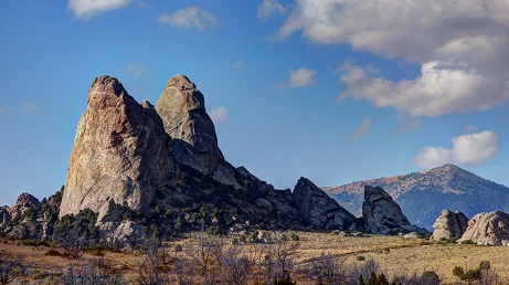
 Anyway, we're here to see the Craters of the Moon, a vast area of lava spewed forth beginning 15,000 years ago from a 52-mile (84-kilometre) series of deep fissures known as the Great Rift that cross the Snake River Plain..

