Saturday, December 25, 2010

As we cross the border from Arizona into California on Interstate 8 near Yuma, AZ, we can see a definitive line of dark clouds hanging over this usually sunny state.  Our aim is to see the Imperial Sand Dunes; yes, more sand dunes.  These are up to 300 feet high and are a recreational haven for riders of ATVs.  They are also on BLM land (remember, usually RVers can camp on BLM - Bureau of Land Management - land for free), but during "dune season" from October to May, RVers have to buy a permit to camp.  Unfortunately, the Ranger Station is closed and we can't find anywhere else that sells the permits - it is very frustrating and quite unfriendly.  Unlike every other state we have ever been to, there is also no State Welcome Center or Visitors Center when you enter on an Interstate.  We keep seeing commercials at home of Governor Arnold and other celebs telling us to come to California, but when we get here there's nothing and no one to help us figure out where to go or what to see!  So we keep driving.

California Day 2, still cloudy - we stop at a gas station in the tiny town of Niland and ask for directions to Slab City which lies on Niland's outskirts.  This is a hippy town that our new friends Janice and Jerry told us about.  It is named for the concrete slabs left behind from a remaining WWII army barracks.

First we come to "Leonard's Mountain", but more on that later.  Then there are the hippy trucks and buses decorated with old hubcaps and God knows what else.  We drive around sightseeing, but also find a place to park the trailer for the night.  There are also many big, expensive RVs and trailers here, so we feel secure that we'll be safe.  The rain starts shortly after we arrive, and it doesn't stop for almost 2 days.  Small clearings appear occasionally, attempting to lull us into thinking it will stop raining, but then they disappear and the black clouds roll in and the rain comes again.  The problem is that the surface we are on is a mixture of tiny stones and clay - very slippery when pulling 12,000 pounds.  So we decide to wait out the rain.

California Day 3, still raining - we stay put.


Leonard in the middle with other tourists - Salvation Mountain
California Day 4, the skies are clear blue and the sun is shining again - we pull out and head for L.A. to meet my uncle for Christmas Eve dinner.  We stop again at "Leonard's Mountain", and this time get out to have a closer look.  And surprise, we get a personal tour from Leonard, the mountain's creator.  What a character!  He is 80 years old this year and started building and painting this mountain to "spread the word of the love of God" 30 years ago.  It is a truly amazing structure, what Leonard has accomplished with adobe and paint, and his message is simple - "God loves us first, so keep it simple".  To him, his creation is called "Salvation Mountain".  Leonard is a delight to talk to.

Along the way north towards L.A., we stop at the Salton Sea, really an inland lake that is slightly more saline than the Pacific Ocean.  It was created in 1905 by the overflowing Colorado River.  It is slowly evaporating, and one day will be gone entirely, perhaps producing another Death Valley.  We also learn that some areas of the state received a couple of feet of rain over this past week, and fellow RVers whom we meet were stuck at their campsites for days waiting out the rain, so we are lucky we had only two days.  My uncle informs us that 20 homes in San Bernardino were lost to mud slides.  What a strange land of extremes this is.

Brad, Uncle Bill and Marilyn, Christmas Eve 2010
It is heartwarming to see my Uncle Bill again.  I haven't seen him for over 23 years - that was when my grandmother died and he came "home" for her funeral.  He left Canada in 1958 and has been here in California ever since.  He just can't stand the humidity of southern Ontario.  He lives in Claremont which, it turns out, is a beautiful little college town.  It reminds me of Niagara-on-the-Lake but with a big university at its heart.  There are quaint shops and restaurants in Clarement Village - and that's exactly what it's called.  There's a bakery where Uncle Bill buys his fresh bread - everything is within walking distance.  There are trees everywhere, and the college campus is huge.  Actually, it's five colleges all together.  Tuition, Uncle Bill says, is $40,000 per year!  The surrounding areas are residential, and nice residential, not slummy.  To the northwest is Mount Baldy, a huge mountain some 10,000 feet high.  It's only about 10 miles away and the peaks are snow covered.  I can see why he wants to live here.  It's beautiful!

Uncle Bill is the last of my father's siblings, four boys.  Bill was the "baby".  He and his brother Frank moved here to California; Frank passed away a few years ago.  My dad and his oldest brother Bob stayed in Hamilton.  Uncle Bill had a pacemaker installed last winter, so I'm glad to finally be able to see him.  I hope to be able to see him on subsequent trips.

Friday, December 24, 2010

Coronado and desert frustrations


We continue our journey west through Arizona, inching closer to California.  This morning the clouds threaten rain - the first of our journey in the south, and we can see that the road is wet as we near the Coronado National Memorial, but we witness not one drop of the wet stuff ourselves.  The park is named after Francisco Vasquez de Coronado, a Spanish explorer from the 1500s who was sent by the King of Spain to look for gold, which he never found (I think he was only looking on the ground, not IN it).  His route took him through the San Pedro River Valley near these majestic mountains.  We drop our trailer in a parking lot at the foot of the mountains, and drive a nail-biting, hair-pin turn filled, one-lane dirt road to Montezuma Pass at the top (elevation 6,575).  What spectacular views of the San Pedro River Valley to the east and the San Raphael Valley to the west.  Many other mountains are visible all around us, but also visible in the east valley below us is a solid, straight, black line which disappears into the mountains beyond.  We read the markers at the peak here and are informed that this is the U.S./Mexican border.  With our binoculars, we can see the American Border Patrol vehicles parked on a dirt road right beside the wall.  We skip over to the other side of the parking lot to peer through the binoculars at the view to the west.  Here, there is no solid black line, but with difficulty, we can spot a barbed wire fence.  The border has cut through the mountain we are standing on, but interestingly, it is more heavily guarded to the east than to the west.  Where we dropped our trailer, the Park Ranger had stopped and told us exactly where to park it; he was carrying some serious artillary - two visible hand guns and who knows what else.  We asked him about the border being so close since it was this morning that we realized we had camped in the RV Park only a few hundred yards away from Mexico.  Drug importation is the biggest threat here.  Inside the park, the Rangers do most of the surveillance and policing, but there are U.S. Border Patrol Officers and vehicles inside the park too.  Anyway, the views are heavenly, and we don't see any illegal immigrants.

Marilyn about to descend into the cave
Marilyn & Brad in the cave surrounded by flowstone
Also inside the park is a cave.  We are allowed to explore this cave on our own, unlike any commercialized cave.  It is a steep .75 mile climb up a rocky trail to get to it (so I'm figuring it had better be worth it!).  It doesn't have a lot of the beautiful mineral formations that many caves like Carlsbad has, but to be able to wander anywhere in the cave is fantastic.  We are not allowed to touch anything because it is still considered a living cave, meaning the formations (stalactites and stalagmites) are still forming, but we see a lot of evidence of vandalism, although it's hard to say when some of it happened.  For instance, all of the stalactites that are within reach of people have been broken off, but did that happen before the park became a park or after?  We suspect before, otherwise the government would likely have protected this cave better.  Also, people have scratched their initials into rocks that have fallen from the ceiling, but thankfully not the columns.  We find a small crawlspace, and Brad starts drooling.  He drops the backpack, grabs the flashlight, gives me the camera and says, "I'm goin' in!"  Great!  We have 2 flashlights and a Coleman lantern, but for me to be left by my lonesome while he scrapes through the hole on his belly into the unknown is still frightening, and damn!  I forgot to get the truck keys from him!  I cannot see his light or hear his voice for at least 5 minutes - an eternity when you are waiting for your spouse in near darkness, not knowing what has happened to them, but he does return, very dusty and dirty.  "I could have gone further," he says, "but it was getting really narrow, and I don't have a helmet or kneepads, and I thought you might be getting worried."  Thanks!  I was, because you have the truck keys!  The cave extends about 600 feet in length, with 20-foot high ceilings.  It is very dry with a mostly sand bottom.  It is a steep decline to get into initally, made all the more difficult because it's like looking into the abyss after hiking in the bright sunshine outside.  But it was a new and exciting experience to explore a cave unsupervised.

The next day, we head further northwest to Tucson and Saguaro (sa-war-ro) National Monument (the western part of the park, as there are two parts).  The road sign says that there is a 12,000 pound limit - yeah, the truck and trailer are pretty close, so we'll give it a go.  It's a steep climb at the beginning, but hopefully the Visitors Centre is nearby and we can find out about the hiking trails.  We come to a parking lot and actually manage to fit all 50 feet of us into it, and ask people if they know where the Visitors Centre is.  "Yeah, it's just up here somewhere."  Thanks for the explicit directions.  We debate whether to turn around and leave, or go on - we both have a bad feeling about this, but we go on.  The park also seems very busy; the traffic is unbelievably heavy, but it is Saturday.  Well, we find no Visitors Centre, just a sign about 3 minutes later saying "Leaving Saguaro National Monument".  Really?  I consult the map again.  Hmm.  Well, I see.  This road does go straight through the park for a short bit.  There was a dirt road that turned to the left, not a road I'd like to take our 31-foot trailer down, and no sign saying there was a Visitors Centre.  Unfortunately, we have no literature on this park, even after all the Visitors Centres in the various towns we've been in.  We decide to move on.  But the saguaro cacti are beautiful, and the concentration of them here is numerically challenging.

After that disappointment, we head for the Sonoran National Monument just west on I-8.  Now remember, national monuments are part of the national park system.  But again - no Visitors Center, no sign that we're even entering the Sonoran National Monument, nothing!  Jeepers!  Why bother naming these bits of desert and putting boundaries around them on a map?  We give up and stop for the night in Gila Bend.  California, here we come!

Funny Grady story.  Brad and I pop in a old Journey CD as we travel along the interstate - the great, old 1980s songs mostly.  It's amazing that after 30 years, we still remember all the words, and yet we have difficulty remembering the details of what we did a couple of days ago!  Ahh, well, back to Grady.  Brad and I are singing along at the top of our lungs, and the tunes are cranked pretty good.  Grady is in the back seat, meowing at the top of HIS lungs - perhaps singing along too, or maybe just trying to be heard.  Maybe he doesn't like Journey.  Randy Jackson, care to vote?  "The cat and the old guy are pitchy, but the pretty, young lady in the passenger seat is pretty good.  She's going straight to Hollywood, baby!"

Saturday, December 18, 2010

Silver and Copper

I'm reminded of Burl Ives' Christmas song "Silver and Gold", except this excerpt is about silver and copper - mine tours.

First stop: Tombstone.  THE infamous Tombstone of the old west.  You know - the Earp brothers - Wyatt, Virgil and Morgan, and Doc Holliday.  The town was discovered by a prospector, Ed Schieffelin, who was told that the only thing he'd discover "out there" was his tombstone, so when he did discover his first silver mine, he named it Tombstone.  The motherlode of silver became so rich, the town that built up around the mines in the area later became known as Tombstone.  It is probably the best preserved living western town - people actually live here, it's not just a staged attraction like a Hollywood set.  Dubbed "The town too tough to die", it has some of the best named merchants ever - Big Nose Kate's Saloon, the Crystal Palace Saloon, the O.K. Corral (where the famous gun fight between the Earps and Clanton Gang is staged daily), the Bird Cage Theatre (with its original and beautiful cherrywood bar, it's said to be haunted and was stage to many famous people, including Sarah Bernhardt), and Boothill Cemetery.


Marilyn at the bar of the Bird Cage Theatre in Tombstone
We tour the Good Enough Silver Mine which opened in 1878.  The labour at that time was all manual, of course - a chisel and hammer.  But the silver ore was rich.  The ore had to be hauled about 10 miles to the nearest river for processing by horse and wagon, and by the 1930s the profit was no longer there so the mine was closed.  We also walk around the town for a couple of hours and have lunch at the Crystal Palace.  The history here is amazing.  Many of the buildings are original, like the Bird Cage Theatre and the Longhorn Saloon, or parts of them are; others are reconstructed.  The town has seen many fires - in 1881 and 1882 - which have destroyed many parts of the town; a fire destroyed the Six Gun City Wild West Show building just last week (arson is suspected).  The town IS a bit of a tourist trap and everything is expensive, but the history is interesting and all of the merchants are dressed in late 1800s garb.  It's interesting to talk to them, just the same.  They all know the history and are all willing to talk your ear off.


Miners working by candlelight in the Queen Mine
Next stop: Bisbee, a small town about 20 miles south of Tombstone, but not nearly so famous.  Bisbee is a beautiful town with Victorian style homes built on the sides of the mountain and shops in the valley, and in view of the tailings of the Copper Queen Mine.  The highway splits the tailings in half with the Lavendar Pit (this is an open pit mine and it is so named after one of the executives of the original owners) on the west side.

Brad working the Queen Mine
Brad and I suit up in yellow slickers, hardhats and flashlights, and board the electric train for an underground Queen Mine Tour with a retired miner.  We get our own personal tour since no one else shows up for the noon tour.  There are approximately 2,300 miles of tunnels under the town of Bisbee, but we will travel only 1,500 feet into one shaft.  The mine operated from 1887 to 1943, producing 8 billion pounds of copper, plus gold, silver, lead, zinc and turquoise.  It was this wealth that led it to being named the "Queen of the Copper Camps".  Our tour guide shows us how the miners drilled during the different eras, progressing from manual chisels and hammers to pneumatic drills.  We can also see where they drilled and blasted the rock with dynamite, finding the veins of copper by identifying the different minerals.  Turquoise, azurite and malachite are typically found where there is copper sulfate.  It's hard for us to believe that these three beautiful minerals were waste rock in those days.  Many of the workers took chunks of them home to make jewelry or other trinkets, or even stone fireplaces and walls.  Today, Bisbee turquoise sells for $2,000 per pound!  Today, the minerals are NOT waste rock.

Museum mineral sample from mine cave
We also visit the Mine Museum in Historic Bisbee, which is affiliated with the Smithsonian Institute.  It is extremely well done with great exhibits showing not only mining life, but life in general.  It also talks about a strange event in 1917 which the local historian, a 90-year old frisky gentleman who fell down a 3 foot ledge and hurt his leg the previous year while hiking (!!!), recounts to us even though a video has already described it to us.  At the time, the First World War was in full force.  Bisbee was the largest producer of copper, and the copper was used to produce shells for ammunition.  In 1917, the mine workers went on strike, their union having somehow been infiltrated by some Germans (this part was unclear).  The miners were mostly immigrants from Britain, Europe, and Mexico.  The Governor deputized 130 citizens and gave them lists of names to round up - in all about 90 were causing trouble, but about 1,800 were actually put on trains and DEPORTED to Mexico, even though most of them weren't Mexicans.  And they were told that the border would be watched and they were not to return; they didn't.  Their families had to join them where they were.  How awful!  The other workers returned to work and copper production continued.  The Governor was not re-elected (it was an election year).

Upstairs in the museum is a mineral display that knocks our socks off!  The azurite, malachite, gypsum, and other mineral crystals that I can't pronounce or recall the names of here are spectacular.  And they are all from the Bisbee mines where workers broke through into caves full of these beautiful mineral formations.  The specimens are said to be worth tens of thousands of dollars each.  It is said that if one area contains 200 different mineral species, then it is rare and an extremely rich find.  There are some 300 different mineral species here in Bisbee!  If you are a geologist (Dolores and Michel), then you must come here!

As we leave our RV Park in the morning (Turquoise Valley - a golf club/RV park owned by a Canadian, no less!), we notice a sign we hadn't noticed before.  The sign tells us our highway is to the left and Mexico is to the right.  How far? we wonder. I look to the right and WOW!  The border fence is right there!  A few hundred yards up the road!  Well, that does explain the number of Border Patrol vehicles we have seen in the area.  I check the map and notice that the town we are staying in, Naco (rhymes with taco), is indeed right on the border and there is a sister town called Naco on the Mexico side.  There is a huge mountain that we've been enjoying the view of too, which must be in Mexico too, we realize.  Huh!  Who knew?

Thursday, December 16, 2010

Chiricahua National Monument

A few days ago, we enter Arizona.  We stay a couple of days in a town called Safford, but we don't do anything there other than have our oil changed in the truck and do our grocery shopping, so let's move the blog along to the Chiricahua (Cheery-cah-wah) National Monument which is in southeastern Arizona in the Coronado National Forest.


Chiricahua National Monument
We find out about this area by picking up brochures from the Visitors Center in Safford, and it looks interesting so off we go.  It's only marginally out of our way (we're heading to Tombstone - yes, THE historic town of Tombstone).  The Chiricahua National Monument is like a huge City of Rocks State Park.  Rock formations, again caused by fallen volcanic ash, compressed into rock, have weathered into columns and pillars of vertical stone, standing like an army ready to march into battle.  The view is so bizarre, to see these pillars amongst the trees and set against the valley below, it looks surreal.

Brad standing on a balanced rock, Chiricahua Nat. Monument
There are many hiking trails in the National Monument.  We take two while we are here.  Echo Canyon to the Grottoes and we do go a bit beyond but because we forgot to bring the map and don't recall how far the trail goes exactly and it's getting late in the day, we simply retrace out steps (good thing too - it's a long trail), and the Massai Point trail at the top of the drive which is a short half mile trail.  You can also take a shuttle from the Visitors Center to the top in the morning and hike your way back down which would take several hours.  I'm sure that would be a great hike, but we decide to move on as the previous night was a very rough one for us because...

At the Visitors Center, one of the Rangers and one of the campers/visitors tell us that we can camp on the BLM land (Bureau of Land Management - equivalent to Crown Land in Canada) in the National Forest just outside of the park for free since our trailer won't fit in their campground and the nearest RV Park is 35 miles away.  We express how long and big our trailer is, and the camper says "Oh yeah, you'll have no problem.  Just don't go too far up the road, because it will get narrow.  But there's lots of dispersed camping up there."  Dispersed camping or free camping is allowed on BLM land anywhere in the U.S. where a previous campsite (with a fire ring or a pull-off) already exists.  AND, the Ranger has a map showing where the National Forest starts and where the dispersed campsites are on the road as the first 4 miles are private property.  So we feel confident that we will find some sites to camp for the night.  We drop our trailer in one of the park's parking lots first near the entrance station, do our hike, and at the end of the day come back and hitch up and head off to find a campsite for the night.  It is dark as we head up the gravel road - and it's a nasty gravel road with that washboard surface, so Brad drives really slowly.
Brad making room for the trailer during the night from hell!

I'll save all the intricate details - we got stuck.  There are NO large campsites for big trailers or motorhomes in this area of the National Forest - none, nada, zilch.  We spend 3 hours - yes 3 HOURS - trying to turn our trailer around in a campsite suitable for a tent or a truck camper.  But it is IMPOSSIBLE - the angles are wrong and there isn't enough space.  During this 3 hour period, I keep catching my pant legs on tiny nettle bushes that I can't see in the dark, scratching my legs and ruining my pants (I'm not wearing jeans tonight), I fall through the cattle guard that is on the road at this point and scrape and bruise my ankle (lucky I don't BREAK my ankle) and I bang my head on the underside of the trailer while walking between the truck and trailer and I stand up too soon, not realizing the trailer is on an angle, resulting in a really big goose egg on the top of my head.  I'm also freezing as I'm the one outside the truck directing Brad which way to turn and how far to back up and whether the truck bumper is going to hit the sign posts on the cattle guard and whether tree branches are going to ruin our roof.  Brad is sitting in the warm truck.  It's about 45F out tonight.  Several times, Brad has to stop, get out and cut down tree brances that are in our way, either beside or on top of the trailer, and yet we still manage to put a few small holes in the rubber roof.  After the first hour, I stop worrying about whether a bear, coyote, wolf or mountain lion will sneak up on me as I am too cold, pissed off and worried to care.  Brad is desperate for a beer.

We finally end up unhitching and taking just the truck up the road to see if there is a place where we can turn around and we do find something where we think we can.  We still haven't eaten dinner and it's after 9:00pm.  So we go back and heat up something to eat - now we're just exhausted.  What will we do once we turn around?  There's nowhere to go.  Up the road from where we are, there is a slight pull-off where we decide to just sleep for the night.  The trailer is hanging on the road about a foot, but we don't care.  This road isn't used much, so it's not like someone will hit us.  It's now after 10:00, so we just go to bed.  In the morning (everything looks better in the morning, doesn't it?), when we're at least rested and I'm not crying, we take the trailer up to the spot we found the night before and Brad has no problem turning the trailer around.  He makes an easy three point turn and we're outta there!  However, we do go back to the Visitors Center and give them you-know-what for sending us up there.  The Ranger (same one) feels really bad when we tell her our story.

We try not to let the night's events taint our feeling of wonder for this place, because it is beautiful and amazing.

Saturday, December 11, 2010

Ghost Towns and Mines

Brad is in his glory. Our hike to the Mogollon Ghost Town and Little Fanny Mine is for most of you who have had the rock hounding or ghost town bug.  We are in Gila National Forest in southwest New Mexico.  This place is rich in mining history and how settlers and those seeking fortune conflicted with and the Apache natives.  This place is like Bancroft in northern Ontario:  it is riddled with hundreds of small old mines and, although the government is imploding mines for liability reasons and looters continue to destroy properties in ghost towns, we come about an amazing ghost town and mine.  The mine is called The Little Fanny Mine and it is located in the old town of Mogollon (Muggy-own apparently, not Muggy-yon if you read the last blog).  The mine produced gold and silver in the early 1900's.  Miners were frequently killed by the Apaches as they were lured into the mountains for gold and silver.  After many years the military eventually set up forts to protect the miners.

Tailings of the Little Fanny Mine
Little Fanny Mine
It is a very steep narrow climb of about 2,000 feet up the mountain to Mogollon.  At a scenic trail lookout, we meet another couple from Tennessee, Jerry and Janice (J&J), who are also rock hounds and we make friends instantly as we all work on finding the ghost town and mine.  First we head up to the old cemetery where we see crosses made of wood and sticks like we see in the western Hollywood movies.  Many miners died within 3 years due to breathing the quartz dust created from their jack-hammers.  Other plots are entire families who all died within the same week likely due to the Spanish Influenza which was rampant during that period (August to November of 1918).  Not too many people lived past the age of 45.

Mogollon Ghost Town
Little Fanny Mine
We then find the ghost town consisting of about 20 cabins, some fallen over, others still standing and in decent shape.  We find old newspapers and magazines between the planks of cabin walls used as insulation (it's always below freezing here at night at 5,000 feet this time of year and days are a nice 60F).  Over 200 people worked the mine around 1900.  We then find the mine.  It is amazingly big.  It takes about 15 to 20 seconds for our tossed rocks to hit the bottom of some vertical mines shafts.  There were many empty barrels of cyanide which was used to leach the gold from the ground up rock.  We then come to the massive processed white quartz tailings which had been crushed to a powder but resolidified with rains over the years.  We could truly feel the hardships of life back then with the threat of Indian attacks, unsafe mining practices, diseases and cold.

The main attraction in this area is the Whitewater Canyon Catwalk.  Originally built in the late 1800s for a mining operation to bring gold, silver and copper down the canyon, the original wooden catwalk has been replaced by a metal one which is used today by tourists.  The canyon is narrow and the walk is lovely.  It is only one mile each way and easy going along the creek.  Although it is the most advertised attraction for this area, our hike the following day would prove to be the highlight of this part of our stay.

Brad in Mineral Creek Canyon
This is the hike that we were referred to a few days back from a volunteer Ranger at The Cliff Dwellings.  Although we know we are about to hike through a beautiful canyon, the Little Fanny Mine was unbeatable.  It just so happens that this hike becomes the scariest.  As we head to the trail by truck the road is so bumpy that it shakes the front plastic bumper partly off the truck.  We have no choice but to return to our campsite to repair it and we head off again.  The problem is that we lost valuable daylight!  Not thinking of it, we start hiking.  We were told that the mine is 2.7 miles and we set our GPS to track our distance.  Surprisingly, the canyon becomes one of the most beautiful canyons that we have hiked.  It is very tall, perhaps 300 to 400 feet hight, and it gets very narrow.  We can't understand how anyone can escape this canyon from the flash floods of Summer.  It is very difficult to photograph since the one side of the canyon is in sunlight and the other side is not, so photos cannot pick up the intense colours of green and orange.  The beauty of the canyon slowly becomes our enemy as we stop frequently to admire the colours and rock formations.  We are losing, again, valuable daylight.

Brad in the mine at Mineral Creek
After hiking 2 hours we can't understand why we have not yet spotted a large boiler that marks the location of the mine.  We check the GPS.  it shows a distance of 1.2 miles.  We can't believe that's all we've hiked.  Brad had remembered one of the two most important things to bring on the hike; his watch (the other is the flashlight).  The sun sets at 5pm and it's 2:30.  In this deep canyon, you cannot predict the time and therefore when it will be too dark to hike out.  Even with a flashlight the canyon would be challanging with the many river crossings required here.  Brad suggests we turn back and try again tomorrow but I suggest to carry on to see if the mine is not far away and there is some mistake with the distance noted on the GPS.  We pick up our hiking speed and within 20 minutes we find the boiler and the mine at 2.06 miles, not 2.7 miles.  We climb the mine tailings to find the shafts.  We soon find them and the supporting timbers are surprisingly in good shape.  The walls of the mine are green and turquoise (copper oxide) and bright blue (Azurite).  We also see lots of pyrite.  Brad writes "I am usually stupidly brave in these mines but while crawling on my hands and knees on a two foot wide path with a wall on one side of me and a "bottomless" vertical mine shaft on the other side of me my heart races.  I am then past the vertical shaft and I continue on walking on large timbers with shafts below me.  My adrenaline pumps.  I finally make it to the main vertical shaft and I can't see the bottom because my powerful flashlight won't shine that far.  I keep calling back to Marilyn to let her know that I am OK.  I can't resist it; I toss a 50 lb. rock into the shaft to get an idea of it's depth.  The rock hits water below after 7 seconds that sends a huge shock wave of sound through the water and into the surrounding rock.  I instantly regret doing this as the shock wave may have been enough to collapse the shafts aroung me.  I immediately turn around and head back out, taking no more photos."

Marilyn crossing Mineral Creek
Limiting our time to only 15 minutes at the mine, we collect up our rock samples and immediately start hiking back.  We are hustling to beat the clock: it's 3:45pm.  Our calves are burning while walking fast.  The temperture starts falling fast.  Brad says "I imagine trying to sleep in the canyon where you can't see your hand in front of your face and the temperature drops from 65F to 20F.  I at least have a lighter and there is dry tree branches for a fire.  However, I'm sorry we don't have a little compact pup tent in our back pack."  We don't hesitate and study the rocks as we have to cross the creek at least 20 times.  It starts to get a little dark and we suddenly see our truck...about 10 minutes away from having to use the flashlight.  That was 70 minutes for 2 mile of rough hiking that took over 2 hours in.  As we get in the truck we are overcome with a thrillseekers' explosion of feelings.  What a rush!  Now my sisters are freaking out and I'm going to get another email chastising me about being careful!

Our last hike on this leg of our journey takes us to the San Francisco Hot Springs.  The trailhead is just off Highway 180 and the hike is 1.5 miles each way.  For the most part, this canyon is not steep like Mineral Creek.  The canyon walls on either side are gentle rolling hills covered with dry grasses and desert scrub.  We are warned that this is cougar country, and Brad has the Bear Pepper Spray - we did NOT see any cougars.  The first mile of the trail is fairly easy although a bit rocky.  The last half mile is a steep grade down into the valley where a creek is flowing.  We have to cross this creek and it is mid-thigh deep, so we have to remove our shoes, socks and pants.  It is difficult to find the pools, which are right along the edge of the creek, because they are so well hidden by the tall, dry grasses.  The pool temperatures are perfect: one pool is about body temperature; the other is about 102F to 104F.

Again, we have the hot springs all to ourselves, which makes the outing so much more special.  We enjoy a picnic and a soak before tackling the steep climb back out of the valley.  Once again, we arrive back at the truck only 10 minutes before it's fully dark, while watching another beautiful sunset of pink and orange clouds.  Another perfect day, another exciting area of New Mexico explored.

Sunday, December 5, 2010

Gila Gila

Our drive up Highway 35 north from Silver City takes us through the Gila (pronounced Heela) National Forest - more steep, twisty, sharp curves up and down mountains; and we can't even take Highway 15 which has too many hairpin turns for a trailer our size.  This forest takes us across the Continental Divide at the elevation of 6,599 feet.  How many of you remember your elementary school geography?  From the Continental Divide, all water flowing east from the Divide will end up in the Atlantic Ocean and all water flowing west will end up in the Pacific Ocean.  It is a monumental moment in the trip - okay, not really; but it is interesting to be this far west and be on the backbone of the continent.  Another interesting sign on the highways around here points out that the "Road is not plowed at night or on weekends".  Well then.  I guess there's only one snow plow driver on staff and he doesn't work overtime!  I hope it only snows during the week around here!

The round trip that we take is called "Trail of The Mountain Spirits" and as Brad reads about the geology of the area it appears that this area is similar to that of Bancroft, Ontario.  There are hundreds of old abandonded gold, silver and copper mines from the late 1800s and early 1900s with collecting sites all documented from local rock clubs.  One volunteer ranger tells us of one abandoned mine in a deep canyon with a 3 mile hike and that's coming up on our route within a day or so.  Brad says "Greg, we should move here for prospecting".  Surprisingly, there appears to be no gold panning, likely because the gold shafts are small and localized like those in Bancroft.

We visit the Gila Hot Springs, a private attraction along the Gila River that includes three separate pools each at different temperatures.  Clothing is optional except during daylight hours on weekends, and we have the place to ourselves like many spots we've visited along our trip thanks to the time of year.  The owner, who is nowhere to be found (and we later learn has had a heart attack and is elsewhere recuperating), has decorated the pools as very rustic huts and the river bank with strangely shaped sticks and teepees and an eclectic assortment of potential wind chimes - it is called "junk art".  It all provides a setting of either utter tranquility or Deliverance, depending on your point of view and past experience.  There are many such hot springs in the vicinity, some of which you can hike a couple of miles to, or this one which is right off the main road behind a horse ranch.  Another cool - hot - New Mexico spot!
Brad and Marilyn in the Gila Hot Springs
On another day we hike to the Gila Cliff Dwellings which are natural caves high up in the side of the cliff in which the ancient Mogollon (pronounced Muggy-yon) people built their homes in the thirteenth century.  It is believed that they only occupied these dwellings for a period of about 30 years, and it is not known why they left.  There are seven caves in all of varying sizes which were unfortunately heavily looted prior to this area becoming a National Monument, but a few artifacts have been preserved and are showcased at the Visitor's Centre.  The southwest is rich in ancient tribal history like this, but few dwellings are as well preserved as the Gila Cliff Dwellings.
Brad at the Gila Cliff Dwellings National Monument
Some people say that excitment comes with risk and our risk is trying to find a place to park this 31ft long, 13,000lbs. fifth wheel trailer. You see, once you have committed yourself down a road, if there is no place to turn around or if the dips are too big to cause the top of the truck box to hit the bottom of the trailer then we have to back up which is extremely difficult and slow.  We typically access website information or talk to locals (if anyone lives around) to know if roads are accessible.  After a first failed attempt to access one remote National Forest campground, we learn of a new type of risk.  We back down a steep, dirt road (about a 10 degree grade) for about only 50 feet from a paved road to test to see if we can get enough traction with the truck to pull the trailer back out.  The back tires spin and then once we shift into 4 wheel drive we slowly are able to pull the trailer back up the dirt road.  Our guess is that we are using about 80% of the 680 ft-lbs. of torque generated from the diesel engine in 4 wheel drive high gear.  It would be significantly less than 80% in four-low gear.  Despite this test, we are a little nervous during our 2 day stay since there is no guarantee that we will be able to climb the entire slope of the road.  Our guess is that a 12% or greater grade and we won't make it, or if the stones on top of the dirt is rounded there would be no way we'd get sufficient traction.  Yes we do make it out (easily) and there is a sign saying NOT RECOMMENDED FOR TRAILERS.  Hey, the only way to know the truck's capability is to get close to the "razor's edge".


By the way, I've added an addendum to my Lincoln National Forest post "A Little R&R" originally posted in November.  See the last paragraph for a tidbit of info I originally forgot to post.

Wednesday, December 1, 2010

City of Rocks

In the middle of a grassy plain of desert is City of Rocks State Park.  Yes, another geologic creation formed by a volcanic eruption.  Almost 35 million years ago, the volcano erupted, spewing ash, pumice and hot gas in an explosion 1,000 times greater than that of Mount St. Helens in 1980.  Because of the intense heat during the eruption, the volcanic material compacted to form the dense rock that forms City of Rocks today.  It has eroded along its cooling cracks, or joints, through freeze and thaw action, wind forces, and the effects of vegetation that grow in the cracks between the rocks.  What makes this park unique is that these rocks seem to only be here.  We can't find anyone to tell us why here and nowhere else.  Dolores, with your Ph.D in Geology, and I know you studied volcanology (or was that Vulcanology?), we're putting you on the case.
Marilyn sleeping in a pool in the rocks, City of Rocks State Park
Today, we can walk between the rocks - or perhaps get lost in them.  The park is only one square mile; a small park by American standards.  Brad and I arrive expecting to spend one night and one day.  We end up spending three nights here, partly because 1) we arrive mid-afternoon, 2) the first two days are cold and windy so we don't get out much, and 3) it is spectacular here.  The tallest rock formations are only about 40 feet high, but we can climb up on top of some of them and the 360 degree views this provides is out of this world.  We are surrounded by mountain ranges; we are in the middle of the valley and the grasses leading in all directions are golden.  It's like being in the middle of the wheat fields on the prairies with the Rockie Mountains all around you (well, the mountains here aren't THAT high).  As the sun sets, the mountains turn purple in the west, and gold in the east - what a sight!

On our second night, the wind finally subsides as the sun sets and we go for a walk in the rocks with our lantern after dark.  The stars are brilliant - there is no moon yet and the milky way stretches from horizon to horizon.  I wish I knew more about astronomy.  I see a few meteors and wish this could last forever.  We reach the rocks at a height where we can look down on the valley on the other side of the park and can see the lights of a small town in the distance.  It is spooky being here all by ourselves, in the dark, even though we have a lantern and a flashlight.  We still have to find our way back - we are not following a marked trail.  Brad insists he can lead me back since he was up here earlier today, but he has no sense of direction and he's had a couple of glasses of wine (Brad's a VERY cheap drunk!), so I'm not very confident.  But we do find our way back, not exactly the way we went in, but we do make it back to our trailer.

So the plan was to leave the next morning, but it's such a beautiful day that we decide to stay.  We hike around in the rocks for a bit, and then decide to move to another site that we find on the other side of the park where no one else is.  There is also no hookups (electrical or water), but for one night we don't care.  We also finally take our bikes down off the bike rack on the back of the trailer - three and a half weeks on this trip so far and we haven't used our bikes once.  We ride around the park, and up to Observation Point which proves to be the best view yet.
From Observation Point, overlooking City of Rocks State Park
We also see more wildlife here than we have anywhere so far on our trip, although just rabbits, jackrabbits and cottontails, and lots of songbirds.  Grady likes the wildlife here, but they do tend to keep him from his naps.

It is here that we meet Bonnie.  She is one of the Visitor Centre desk attendants.  Bonnie is from Washington state, but has been travelling in a fifth wheel for almost eight months, moving from one state park to another volunteering her time as an interpretive host, park host or visitor centre attendant.  For this, she gets free accommodation at the parks.  She has stayed in many parks in California, Arizona and now New Mexico, which is her favourite; in fact, she is looking for property here.  We talk to Bonnie at length about volunteering in the parks.  She does it because she wants to give back to her community and her country.  Others do it because it can be an economical way to travel and meet people.  Hats off to Bonnie; she put up with all of Brad's questions, including his daily question - why are these rocks here and nowhere else?  The answer?  Because they are.

Valley of Fires

North of Alamogorda, near Carrizozo, New Mexico, is Valley of Fires.  This is a lava field 44 miles (71 Km) long and 2 to 5 miles wide through the Tularosa Basin which flowed southward after spewing from volcanic vents on at least two occasions, most recently about 1,500 to 2,000 years ago.  We are camped on a kipuka (a cool Hawaiian word - say it), which is an area of higher ground that the lava flowed around, leaving these islands of sandstone and soil.

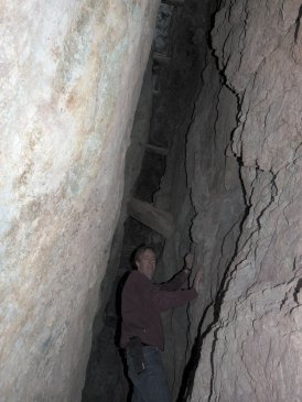
The crusted lava looks like it has flowed quite slowly as it is very swirly (a very technical geological term, right Dolores?), which makes the black patterns very beautiful.  It almost looks like and artist's canvas or a lazy river at Disney World.  We are in a valley and the land here is quite flat except for the "kipukas", so perhaps the flows were slow, causing the twisted flows.  The Recreation Area where we are camped is centred around fallen lava tubes and bubbles, so many areas are sunken.  The loose pieces of lava sound like broken glass, although they are heavier than the lava we experienced in Arizona where there are hundeds of volcanic cones.  The visitor's centre says that this lava is olivine basalt, similar to Hawaiian lava flows.  In this valley, the flow is so rough and broken, it could only be crossed on foot (as opposed to a donkey cart, I suppose).  We are surprised to learn that we are allowed to walk anywhere on the lava field, not just along the path, but the lava is fairly sharp so we have to be careful, although we do not venture far.  This area contains many pressure ridges, fissures, lava bubbles where gases built up when the lava was hot and collapsed as the lava cooled, and tubes where the lava once flowed and then collapsed as it cooled.  It is difficult to climb, especially with cacti in the way.
Marilyn a little off the path
Many plants and animals live here in the lava field; in fact there is more plant life here than we have seen anywhere so far in our desert travels.  There are junipers and many kinds of cactus including the ever-present prickly pear, grasses, the banana yucca, the sotol (which resembles the yucca but isn't), and annual & perennial flowers (which are out of season now).  We don't see any wildlife (none, nada, zilch), but apparently this is home to the kit fox, coyotes, deer, many birds including owls, eagles, hawks and other small perching birds (okay, I saw about a dozen little birds), snakes (in hibernation now, thank goodness), rodents, rabbits, a small band of Barbary sheep, bobcats and rigtail cats.

The first day we are here is totally overcast in the morning (our first cloudy day) and VERY windy and cold.  In fact, in the morning, we can't see the northern end of the eastern mountain range - the Sacramento Mountains.  At first, Brad thinks it is fog or mist, but then I see a few dry flakes of snow falling outside of our trailer windows and we realize that there is a blizzard blowing in the mountains obscuring our visibility of the range.  Okay - I'm really sure we left home to escape SNOW - hoser!  But here it is, almost as far south as we can go in the state of New Mexico anyway.  Fortunately, we don't get any more snow than those few dry flakes.  The sun finally comes out mid-afternoon and so we walk the trail through the lava flow, but man, is it cold!  I think my ears are going to fall off.  I have brought a winter coat and this day I have to use it.
The broken flows of Valley of Fires Recreation Area
The second night we camp here, the temperature drops to 10F (that's about -15C)!!!  Our water hose outside stands up all by itself even though Brad disconnects it from the tap and our trailer so we don't burst the couplings.  We're pretty sure the water in our tanks is at least slushy, but nothing seems to have frozen.  The second day is sunny and warmer (if you're in the sun).  No wind today.  Brad goes out and hikes the trail again before we leave to go back to Alamogordo.  I stay inside trying to warm up - I'm having one of those days where I just can't get warm, even though I have the temperature inside the trailer up to 80F!

And a funny thing happens on the drive back to the city.  It's only a one-hour drive back south to Alamogordo, so I don't bother to put Grady's food and water dishes in the back seat of the truck.  Surely he can survive for one hour without them.  Apparently not!  About five minutes into our drive, he starts howling from the back seat, and wandering from the back seat to the front seat and back again.  The howling won't stop.  We can't figure it out.  He hasn't howled in the car since day 2!  I try to put him on my lap, but he won't settle - he goes to the back seat and howls again.  I say to Brad, "Maybe he's upset that I didn't put his food and water dish back there.  Maybe he's hungry or thirsty all of a sudden.  I think you're going to have to stop and I'm going to have to get them from the trailer."  Fortunately, we're not on a busy highway, so Brad stops at a small pulloff, and I get Grady's life sustenance from the trailer, and put them on the floor in the back seat where they belong.  As we get rolling again, Grady checks the dishes out, but does not eat or drink, jumps up on the centre console between Brad and me, and goes to sleep.  "All is well now.  Whew!  Everything is in place.  My food has not been left behind and I will not starve to death for the rest of the trip."  Stupid cat!

The reason we return to Alamogordo is because we are booked into a tour to Lake Lucero at the White Sands National Monument on Saturday afternoon.  This is a Ranger-guided auto caravan across a military missile base to a dry lake bed to see selenite crystals that eventually become the white sands in the dunes we saw the other day.  Another geology lesson?  Surely you've had enough?
Selenite crystals stuck in the gypsum at Lake Lucero
The selenite crytals are beautiful - very sharp around the edges, but very soft on their face - you can score them with a fingernail.  They can be dissolved in water, and eroded by the wind, thus creating the sand dunes.  Selenite crystals are just the way that gypsum forms when it cystalizes.  Every mineral has certain properties and these are gypsum's.  Some crytals are four feet long, but are mostly underground, exposing only a few inches or a foot perhaps by heavy rains.  They protrude from the ground at sharp angles, so you wouldn't want to be walking out here in bare feet.  Their colourings range from a light tan colour to almost green, depending on the mineral in the ground where they form.  They are odd and stunning to witness.  They glimmer when the sun hits them (yes, another sunny day).  What a fantastic opportunity to come see this.  There are only two tours per month on the last Saturday of each month - rules of the military base.

American military paranoia?  We had to drive our trailer in to the Lake trailhead (18 miles across the base), which was no big deal because the road was paved.  We weren't allowed to leave it just off the highway outside the base gate.  Also, no photos could be taken during the drive across the base - it was barren desert!  We were not allowed to stop our vehicles along the drive to the trailhead while on the base.  The rules were very explicit.  I think we might have been shot if we'd disobeyed!  We were joking with our park ranger guide before we entered - "We have come to see your nuclear wessels."  Remember the line from "Star Trek 4, the Voyage Home", spoken by Chekov in his Russian accent?  The Ranger got it right away and laughed like crazy.  "Yeah, you'll probably be shot," she laughed.  The base is a missile test range, and they do run at least two tests per week, which is a shame so close to such a beautiful natural area.    Only in America!