Friday, December 30, 2016

Lake Mead and Valley of Fire State Park

Just outside of Las Vegas is one of our favourite areas. The Lake Mead National Recreation Area is a beautiful spot to camp over the lake, and Valley of Fire State Park is a spectacular area of bright red/orange sandstone formations with great hiking.
Hanging out at Lake Mead with new friends

We meet a new friend, Jody, while hiking in Valley of Fire State Park, and she comes to join us camping at Lake Mead for a few nights. She and I quickly become best buddies, laughing and carrying on. Poor Brad. She also has the cutest little dog, BooBoo, whom Grady attacks. Poor BooBoo.
A night at the campfire with Jody and Grace, whom we first met last year outside of St. George. Strangley, we run into Grace and her hubby Greg camped here at Stewart's Point; in fact, they are in our favourite spot. Such a strange coincidence.
Grace takes Brad out kayaking on the lake on a very calm day.
Carroll Shelby Museum in Las Vegas
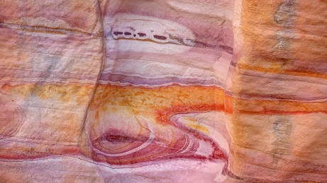
Brad is in heaven, surrounded by so many Shelbies and Mustangs made into Shelbies. From the old Cobras to the new Shelbies, including a Shelby 1000 pictured here (that's 1,000 horsepower and it's barely street legal!), there's a wide assortment of everything ever touched by Carroll Shelby.
Inside the shop. Shelby is not a car manufacturer. They only modify cars. The old style Cobra seen here is a brand new car, and neither of the two vehicles in the foreground have an engine in them - yet. This tour was very interesting and worthwhile, and best of all it's free. I highly recommend it to anyone who loves cars in general and Shelbies in particular, and tires of Las Vegas strip.
Hiking
On the Arches Trail in Valley of Fire State Park, a group of horsemen/women ride past us. Smart - the sand in the wash on this hike is deep and going is tough. Even the horses are sweating and it's only about 55F today.
A hike into the Bowl of Fire in Lake Mead National Recreation Area. It's a stunning outcrop of very red/orange rock against the brown Muddy Mountains.
We hike from the main road in Valley of Fire State Park with Jody through Wash #3. This area makes us all think about Orange Cremesicles because the rocks are striped white and bright orange. Sadly, no ice cream can be found within 20 miles.
Brad and I have hiked this wash before and we know there is an area of rock with beautiful, colourful striping. We're very happy that we actually are able to find it, after a 3 year absence. This is a small section of rock wall about 3-4 feet across.
Another abstract section of rock wall about 1-2 feet wide. Reminds me of an alien spaceship looking for a landing site.
Last one - these are just so cool. This one is probably only about 1 foot wide.

Monday, December 12, 2016

Partying at the Porters' Project and Party Place, Lake Havasu City, Arizona

It's great to have such wonderful friends down here in the southwest. We join two other RV couples at the Porters' Party Place for the American Thanksgiving. There is a lot of eating and drinking, a bit of swimming (temps are a bit cool even though the pool is heated) and much hot tubbing.
Brad working hard
Paul and Sue built a house in Lake Havasu City two summers ago, leaving a life of full-time RVing for a part-time home, part-time RV lifestyle. Fortunately for their friends (including us - YAY!) they added 3 spaces with RV hookups outside their beautiful new home, and they love having visitors. Especially since a visit is the perfect time to get some help with heavy work, like planting a 6-foot palm tree. Brad, Tom and Dave help Paul plant two trees this week. Brad also takes the opportunity to fix a crack in the outer shell of our trailer (with a lot of advice from everyone) and replace our truck's driver's side mirror which broke requiring an electronic part.
Hiking Lizard Peak
Sue takes Brad and me up Lizard Peak, about a 2-3 mile steep hike. At the top is this picnic table which was carried up the difficult trail we just climbed. That's determination! This view looks down the Colorado River, south towards the Parker Dam.
This view looks north towards Lake Havasu City.
The Boat Parade
Christmas is less than one month away, the lights are being hung all over town, and we attend the annual Boat Parade at the canal. This cute little tug also has fake smoke puffing out of its stack and takes a spin (literally) every once in a while.
Probably the most lights on one boat.
Santa and his sleigh. Ho Ho Ho!
Hiking SARA's Crack
Every year when we are in town (sometimes for the fireworks in February, last year for Christmas at the Porters') we have wanted to hike SARA's Crack, but it's been too hot or we've been too busy. This year, we finally do it. The Crack is a short slot canyon with a bit of rock scrambling required.
This is the biggest drop, and a rope is provided. I do great at first, until my heel steps on the rope and I go off balance and smash my elbow into the wall to my right. I'm not really hurt, and we all have a good laugh.
Sue shows us the slide method.
Paul show us all how to do it right!
The 2.5-mile trail leads down to Lake Havasu in a pretty little cove where we sit and have lunch with the ducks and coots (not just the 3 old coots we walked down with LOL!) before making the 2.5-mile trek back. So glad we finally get to do this cool hike.
A Christmas Lights Walk in the English Village of Lake Havasu City
Paul, Sue, Brad and I walk along the canal at the London Bridge to see the Christmas lights. This is the English Village lit up like Clark Griswold's house! Have you ever seen so many lights?
Paul, Brad and Sue with the London Bridge in the background. It is a beautiful, warm evening with no wind.

Saturday, November 26, 2016

Grand Canyon National Park, Arizona

While we have visited the Grand Canyon at least twice before this trip, we have never hiked in the park. Since we have a few days to "kill" before Thanksgiving celebrations with friends in Lake Havasu City, we stop at this world-renowned destination to fulfill that wish, even though temperatures plummet. The Grand Canyon is at almost 7,000 feet and a cold snap with strong winds comes in the day we arrive. Temps drop to 23F overnight and only about 45F during our first day here (as you'll see from the photos of our hike on the South Kaibab Trail how bundled up we are), but thankfully rise after that to a pleasant 65F during the day and only around 40F at night. Thankful for our propane heater in the trailer.

South Kaibab Trail Hike
South Kaibab Trail Switchbacks
The South Kaibab Trail leads down to the Colorado River, about one vertical mile below the rim on the canyon floor. You can hike down this trail and come up the Bright Angel Trail (another rim to river trail), or vice-versa or down and back up, but it requires a backcountry permit and a tent because you're staying overnight! The beginning of the trail is steep, hence these switchbacks.
Mule riders coming up the South Kaibab Trail
This is simply cheating in my opinion. According to park staff, there has never been a fatality involving these sure-footed animals. The mules are purchased from approved suppliers when they are young and trained for 9 months. Those mules who successfully complete training work for 20 years before they are retired. An adoption program is available for retired mules and, believe it or not, there are more applications to adopt than mules. Nice to know they are well treated.
Mules packing out gear from the Phantom Ranch
The Phantom Ranch at the bottom of the canyon has closed for the season and these mules are bringing all the gear up. The ranch accommodates hikers and rafters.
Brad and I posing at Ooh Ahh Point
Ooh Ahh Point (yes, it's really called that) is as far as we go down the trail, only one mile, but we don't expect the views to get better as we descend further. And there's always that climb back up. While this is our coldest day at the Grand Canyon, the wind hasn't found its way down into this part of the canyon and we're pretty warm with the sun shining. It's a lot colder up on the rim with 30 mph winds blowing.
Squirrel at Ooh Ahh Point
Some of the local wildlife at Ooh Ahh Point. He's quite the poser and a bit of a beggar. Most injuries in the park are due to wildlife bites from people feeding them.
Brad enjoying the view at Ooh Ahh Point
Another gorgeous view from Ooh Ahh Point.
The South Rim
Can you see the tiny people near top left?
After hiking the South Kaibab Trail, we decide to hike back to the Visitor Center along the Rim Trail, about 1-2 miles. This is a view of Mather Point (which is near the Visitor Center) from the Rim Trail.
The Bright Angel Fault/Canyon
That chasm from the middle to the top of the photo on the right side is the Bright Angel Fault looking towards the North Rim. The Bright Angel Trail is probably the most popular hiking trail in the park. The North Rim is about 1,000 higher than the South Rim, making it colder although snow hasn't fallen yet. The North Rim will close within a couple of weeks, by the first of December.
Finally a view of the Colorado River from Pima Point. A fantastic shuttle bus system takes visitors all over the park since it's such a busy, crowded park and parking vehicles would become impossible. Visitors can park at the Visitor Center and take the shuttle almost anywhere - to the campgrounds, shops, train station, hiking trails, geology museum, and rim overlooks. This part of the park (from the Village Transfer Route to Hermit's Rest) is one of the few routes that allows no other vehicles at all; shuttle buses only. This system, implemented in many busy parks, gives us a break from driving and time to enjoy the views. Conveniently, shuttles run every 10-20 minutes all day long.

We're so happy we finally get to hike in the Grand Canyon, Arizona's jewel. Next, we head west to spend Thanksgiving with friends in Lake Havasu City (elevation 600 feet instead of 6,000, so my head and lungs will be happy!) I won't be blogging about that, but be assured there will be a lot of eating, drinking, swimming, spa soaking, and general fun! My Facebook friends have already seen it!

Canyon de Chelly National Monument, Arizona

Numerous times we have wanted to visit Canyon de Chelly (pronounced de Shay), but it has been snowing or too cold every time we were in the area. So we are excited for the unusually warm fall this year when we are passing through northeast Arizona on our way to Lake Havasu City for Thanksgiving.


Located on the Navajo Indian Reservation, this national monument is sacred to the natives who live here. The canyons are still inhabited by a few Navajo families following the old traditions. This gorgeous viewpoint at Antelope House Overlook shows Canyon del Meurto (Canyon of Death) on the left and Black Rock Canyon to the right.
The Antelope House ruins, built at the bottom of the Canyon de Chelly. While there are many side canyons, Canyon de Chelly and Canyon del Muerto are the two main canyons of the park.
Following the North Rim Drive along Canyon del Muerto there are three overlooks. The first is Antelope House, and the second is Mummy Cave shown here. This is one of the largest ruins in the canyon believed to have been occupied until 1,300 AD.
The final overlook on the North Rim is Massacre Cave, which has a brutal history. In 1805, about 115 Navajo thought they would be safe from a group of Spanish military by hiding in this cave. But when they were discovered, the Spaniards opened fire from the rim, killing everyone on the ledge. Their refuge became a death trap.
From the South Rim, a view of the White House ruins, built and occupied about 1,000 years ago. The name comes from the white plaster wall in the upper dwelling.
The White House Trail is the only access into the canyon and ruins without a native guide. The trail is not difficult and is only 2.5 miles round-trip, although it descends about 600 feet into the canyon, and of course 600 feet back up. Many horses roam through the canyons.
White House from inside the canyon. Brad is pictured with Sam, a young girl from Texas who asks if she can hike this trail with us since she is traveling alone and a bit nervous hiking into the canyon by herself. Of course, we are happy to have her along.
Just a beautiful shot of the cottonwood trees along the dry creek at the White House ruins.
Spider Rock is at the end of the South Rim Drive. The spires climb 800 feet from the canyon floor.

Friday, November 25, 2016

Mesa Verde National Park, Colorado

Only 3 hours from Moab, Utah in the southwest corner of Colorado, we take a quick side trip to Mesa Verde National Park.

The park and the ruins are over 1,000 feet above the valley. The Mancos Mountains are snow-capped, and it is much cooler here. The highest elevation in the park is over 8,400 feet. Mesa Verde contains some of the best preserved cliff dwellings in the world built by ancient pueblo people, the Anasazi, who populated the Colorado Plateau starting about 1,500 years ago until about 800 years ago.
Of over 4,500 archeological sites, only 600 are cliff dwellings, like this most famous ruin, Cliff Palace. Unfortunately tours have ended for the season and that's the only way to get a closer look. During off-season, only the rim drives are open with overviews of most of the ruins.
It is mind-boggling to imagine how the Anasazi accessed these homes. Many dwellings have evidence of toe and finger holds carved into the cliff walls. While these incredible builders lived in this area for 700 years, no one knows what caused them to leave in about 1,200 AD, but the cliff dwellings have been vacant since that time.
Near the very informative museum is Spruce Tree House. Mesa Verde NP also contains numerous sites of pit houses built on top of the mesas, but the cliff dwellings are the most intriguing. Pit houses and villages were built prior to the cliff dwellings, but were dangerous places, many succumbing to fires.

Moab, Part 3 - More Great Stuff around Moab, Utah

Still in the Moab area, we find some beautiful places to explore outside of Arches National Park. We don't really even venture into Canyonlands National Park as we spent a full week hiking here a few years ago. And there's so much other new stuff to do and see around here...
Highway 128 along the Colorado River
Castle Valley - The Priest and Nuns
We take the La Sal Mountain Loop Road just south of Moab. The views above the city are beautiful, but the photos are not as they're into the sun. This view of the rock formation called the Priest and Nuns in Castle Valley at the end of the loop drive is the best from our day.
Morning Glory Natural Bridge
An easy, 4-mile hike up Negro Bill Canyon (aka Grandstaff Canyon) leads to Morning Glory Natural Bridge. Its huge expanse is hard to capture in a single photo.
The beautiful Colorado River
A beautiful resort with at least 50 cabins along the Colorado River near Castle Valley. Some cottonwood trees are still bright yellow, contrasting with the red rock.
Potash Road and the Shafer Trail
Brad overlooking the Colorado River
We spend a full day driving Potash Road from Moab. Here's Brad at Thelma and Louise Point, technically called Fossil Point for its marine fossils found in the rocks 1,000 feet above the Colorado River.
Thelma and Louise Point
The final scene of the movie, Thelma and Louise, was shot here. The car was ejected over the cliff just beyond the promontory in the middle of this photo.
Me overlooking a tributary along Potash Road
We started our drive on Potash Road in Moab just before lunch, and stopped to enjoy the views so often that it is getting dark by the time we get to the spot where it intersects with the Shafer Trail leading us back up to Canyonlands National Park and our campsite on Dubinky Well Road. This tributary, when there's water, falls about 400-500 feet over this smooth, rocky waterfall and joins the Colorado River just around the corner.
As we ascend the steep switchbacks of the Shafer Trail, it's fully dark and we are surprised by a group of bighorn sheep who run across the road in front of the truck and disappear over the cliff's edge.
The switchbacks of the Shafer Trail
On another day, we start down the Shafer Trail late in the morning to retrace our drive backwards towards Potash Road since it was dark when we finished that previous drive and we missed some great views. These are some of the switchbacks that descend the steep cliff and lead to Potash Road and the White Rim Trail, the latter a 100-mile dirt road that follows the rim above the Colorado and Green Rivers, and is a popular backcountry 3-4 night trip for cyclists.
Panorama at the Gooseneck on Potash Road
We have lunch at the Gooseneck below Dead Horse Point State Park and spend a couple of hours just enjoying the view and soaking up the sun. The road (Potash Road at this point) is fairly well travelled by all types of vehicles although parts of the road from here to the Shafer Trail are fairly rough.
Fisher Towers and Onion Creek
Climber at Fisher Towers
About 20 miles east of Moab on Highway 128 is the Fisher Towers trailhead and small campground. This trail is popular not only with hikers but also climbers. There are several climbing routes in this rocky ridge, but this one seems to be the most popular.
A bigger view of the rock ridge. Note the formation being climbed in the previous photo is the second "peak" from the left. The hike is fairly easy (if you're not afraid of heights), but longer than it looks as the trail follows the canyons created by erosion - in and out, in and out. From the viewpoint at the end of the trail, the parking lot is barely one mile away as the crow flies. We have hiked 2.2 miles. Oh well, the views make the trail worthwhile.
Brad overlooking Onion Creek
Below Brad is Onion Creek Road, which we drive on another day trip. It's a lovely drive through the canyon, then through and above Fisher Valley, eventually climbing North Beaver Mesa and looping back to the highway through Castle Valley.
This dinosaur trackway is not advertised on our map so is a nice surprise to find along Polar Mesa Road just before we descend into Castle Valley. There are numerous tracks found in this location with a short interpretive trail, and fabulous views of Bull Canyon and Fisher Valley if you follow the social trail along the rim.