| From the Narrows Rim Trail overlooking the lava field. Notice the many collapsed areas which are probably lava tubes, now caves. Can you see Brad sitting on the left? | |
| Also from the Narrows Rim Trail, a close-up of the strange "Ropy Pahoehoe" on the lava. | |
| A lava cave-in on the Zuni-Acoma Trail. Notice the yellow wildflowers. | |
| Brad on the Lava Falls, where lava from the McCarty's eruption only 3,000 years ago dripped over the edge of a crevice. | |
| A fabulous view of the lava field (on the left) from the Sandstone Bluffs Overlook. Mount Taylor, at over 11,000 feet is in the background. | |
| Marilyn entering Junction Cave in the El Calderon area, the oldest volcanic region in the park. | |
| Marilyn in the Xenolith Cave in the El Calderon area, a very short hike before a 10-foot drop stops the progress of unskilled cavers. | |
| La Ventana (The Window), a 180-foot arch in the sandstone cliffs east of the lava field. | |
| Thanks to all of the recent rains, which have been washing out roads and flooding parks, the wildflowers are starting to bloom. There are reds, purples, yellows and oranges, and the grasses have greened which makes for a welcome change to the usual desert brown. |
Our retired travels around the U.S. Southwest.
To SEARCH this blog or see a LIST OF PLACES, go to the Web Version.
Monday, September 30, 2013
El Malpais National Monument, NM
About one hour west of Albuquerque, New Mexico is the El Malpais [pron. MAL-pay-ees; means Badlands] National Monument as well as the El Malpais National conservation Area. Here we enjoy a free BLM campground with great views of sandstone bluffs and Mount Taylor (New Mexico's tallest peak at over 11,000 feet). We hike trails overlooking and through the black lava beds that were created by the volcanos on the west side of the park; we explore caves that were once tubes where lava flowed underground. This land is ageless: the orange, sandstone bluffs formed 138 million years ago and since then formations like La Ventana have been created by erosion; the oldest volcanoes started erupting 750,000 years ago and continued until as recently as 3,000 years ago; native pueblan peoples inhabited the area from 1,000 years ago; 500 years ago Spaniards conquered the land; and 26 years ago the area was designated as a national monument, preserving the history and geology for us to enjoy. We are surprised by the beauty of the area, although I don't know why - New Mexico has never failed to enchant us.
Sunday, September 22, 2013
Kashe-Katuwe Tent Rocks National Monument, NM
Between Santa Fe and Albuquerque, New Mexico is the Cochiti Pueblo and Indian Reservation. On the Reserve is the Kashe-Katuwe [pron. ??? - I'll guess at KAH-shay KAH-too-way and means White Cliffs] Tent Rocks National Monument, an area of volcanic tuff and hardened pumice eroded into tent or cone shapes. Only two trails are open - the Cave Loop Trail and the Slot Canyon Trail; the Veteran's Memorial Scenic Overlook and upper Loop Trail are closed due to the recent flooding. As we hike, not only are we treated to the incredible tent rock formations, but also magnificent views of the valley and surrounding mountains as we hike up the slot canyon to the top of one of the mesas. What a truly enchanted land.
| Cochiti Lake, flooded after the rains of mid-September. That's debris washed down the Rio Grande in the foreground and the roofs of picnic table huts and a washroom in the background! | |
| The Tent Rocks from the Slot Canyon Trail. | |
| The layers of various rock and pumice left by the volcanic eruptions and eons of time. | |
| Brad and Marilyn near the top of the Slot Canyon Trail. | |
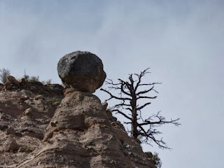
| Strange erosion | |
| From the Cave Loop Trail looking up onto the top of the Slot Canyon Trail where we had previously stood. It's hard to see in a small photo, but the Ravens are catching the thermals near the peak in the middle of the photo. |
Saturday, September 21, 2013
Los Alamos and Bandelier National Monument, NM
Due to the heavy rains of almost one week ago - the same rains that caused the severe flooding in Colorado - Bandelier National Monument is closed, but thankfully the campground is still open. Knowing there are other things to do in the area, we set up camp here anyway and explore these other sites while waiting for the trails in the park to re-open.
First stop is Los Alamos, a small town perched atop a mesa in the beautiful Jemez Mountains and made famous by the Manhattan Project in the 1940s. I keep hearing Sting singing "How can I save my little boy, from Oppenheimer's deadly toy?" as it was here that the world's first atomic bomb was built in utter secrecy by a large team of brilliant scientists lead by J. Robert Oppenheimer. While I knew that the Manhattan Project started here in Los Alamos, I didn't realize that the Los Alamos is the center for the country's National Laboratory, which is responsible for developing new technologies for defense, space exploration, medical advancements, and more. The Bradbury Science Museum showcases the LANL's history (beginning with the Manhattan Project) and current work. Brad and I even attend a one-hour lecture on explosives given by LANL staff. Pretty scientific stuff, but the chemistry and pyro-techniques are right up Brad's alley. Here's what I remember - the LANL is responsible for the development of nearly cloudless fireworks, useful for theme parks who thrill guests with a fireworks show nightly but are mindful of air quality.
The museum includes many hands-on exhibits about nuclear weapons, WWII, space science including the Mars rover, radiation, nanotechnology, and more. It is like being back in school and our brains are exhausted after spending several hours watching the films and wandering the exhibits. While photography is allowed, we don't take any photos in the museum. If you're interested, check out their website which
includes a link to the movie "The Town That Never Was" on YouTube that explains the history of the Manhattan Project.
We also visit the Valles Caldera (pron. VIE-ez), the sunken cone of the dormant Jemez (HEY-mess) super-volcano. The caldera is 12 miles in diameter (hence the reason it's a super-volcano and not just a volcano) and is now a beautiful meadow that feeds cattle and herds of elk.
Bandelier National Monument is a large federal park on the side of the ancient Jemez Volcano. It is where we camp. The main part of the park is in Frijoles (pron. Fri-HOLE-ays) Canyon, which was devastated by flooding during the recent torrential rains. By our third day here, the park is finally open and we tour the ancient cliff dwellings of the native pueblo peoles. We join a ranger-led guided tour; our guide is a Cochiti Pueblo Indian (they still us the term "Indian" here) and shares many native stories with us. She makes the tour so much more enjoyable.
| Valle Grande, overlooking the Valles Caldera. There are elk and cattle grazing, but too small to see in the photo | |
| A cool, unidentified lizard we meet at the White Rock Overlook Park | |
| Brad at the White Rock Overlook Park, high above the muddy Rio Grande | |
| Marilyn following the path of the Ancients at Tsankawi, an ancient Pueblo. These paths were worn by the natives travelling along the rock cliffs. | |
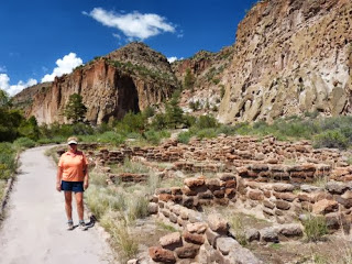
| Marilyn at the ruins in Frijoles Canyon, Bandelier National Monument. Some people lived in the valley near the river, and others in cliff dwellings above to the right. | |
| Brad in front of Long House, a 1/4 mile long series of cliff dwelling ruins | |
| The remaining walls of the valley village at Bandelier National Monument from the cliff dwellings | |
| Some of the destruction caused by the floods of last week, along the Frijoles Creek near the Visitor Center at Bandelier National Monument. Rangers say that the water rose over 13 feet! |
Labels:
Bandelier National Monument,
Los Alamos,
New Mexico
Taos Pueblo, NM
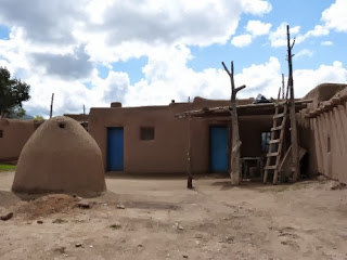
Between Wild Rivers NRA and Bandelier National Monument, our next destination, we stop at Taos Pueblo - "Place of the Red Willows", a small native village just outside of Taos, New Mexico. A Unesco World Heritage Site, it is believed to be the oldest continuously inhabited village in all of the United States, dating back at least 1,000 years. The village and its people have survived many conflicts, first from aggressive, rival tribes, then in the 1600s and 1700s by conquering Spaniards, and finally in the 1800s during the US/Mexican war. Today, the few remaining natives maintain their ancient customs and way of life, including living in adobe homes without electricity and running water, although they do own vehicles.
We take a tour around the village with native guide who describes the history and explains the day-to-day life. Then we are left to wander the many shops and streets on our own. We have a delicious lunch of "fry bread", seemingly a flour tortilla dropped for about one minute into boiling oil. We first have a taco with this bread with seasonsed beef, lettuce, tomatoes and cheese, then finish off with another fry bread topped with honey and cinnamon for dessert. Mmm-mmm! I have never eaten such a yummy, fast meal.
We take a tour around the village with native guide who describes the history and explains the day-to-day life. Then we are left to wander the many shops and streets on our own. We have a delicious lunch of "fry bread", seemingly a flour tortilla dropped for about one minute into boiling oil. We first have a taco with this bread with seasonsed beef, lettuce, tomatoes and cheese, then finish off with another fry bread topped with honey and cinnamon for dessert. Mmm-mmm! I have never eaten such a yummy, fast meal.
Monday, September 16, 2013
Wild Rivers National Recreation Area, NM
Well, it's still raining off and on throughout the days we spend at Wild Rivers National Recreation Area near Questa in northern New Mexico, north of Taos. We are on a plateau between two mountain ranges - the Tusas Mountains to the west and the Sangre De Cristo Mountains to the east. The black clouds and thunderstorms certainly hover above the mountains daily and cause flooding all around us; but we are safe on the plateau.
The park is named for two rivers that converge here - the Rio Grande on the east and the smaller Red River on the west. Both rivers are muddy and flowing very fast due to the rain. Apparently, they are great for fishing trout. On two separate days, we hike down the gorges to each river. The rock here is all volcanic and makes for a dramatic backdrop to the tall Ponderosa Pines, New Mexico's state tree the Pinon Pines, and fragrant Rocky Mountain Junipers. During one of our hikes, we spotted a Yellow-Bellied Sap Sucker - beautiful bird with a yellow belly, red throat, and black with white spots on his wings. Unfortunately, he was too elusive for a photo.
The park is named for two rivers that converge here - the Rio Grande on the east and the smaller Red River on the west. Both rivers are muddy and flowing very fast due to the rain. Apparently, they are great for fishing trout. On two separate days, we hike down the gorges to each river. The rock here is all volcanic and makes for a dramatic backdrop to the tall Ponderosa Pines, New Mexico's state tree the Pinon Pines, and fragrant Rocky Mountain Junipers. During one of our hikes, we spotted a Yellow-Bellied Sap Sucker - beautiful bird with a yellow belly, red throat, and black with white spots on his wings. Unfortunately, he was too elusive for a photo.
Wednesday, September 11, 2013
Starting Our Fourth Year in Northern New Mexico
After an uneventful four-day drive across Michigan, Ohio, Indiana, Illinois, Missouri, Oklahoma and the Texas panhandle, we reach our first destination of the 2013-2014 trailer travel year in northern New Mexico at the Capulin Volcano National Monument. This area of New Mexico is littered with extinct volcano cones dating back millions of years. The Capulin Volcano erupted most recently, about 60,000 years ago. At an elevation of over 8,000 feet, the 360 degree views from the Rim Trail are stunning. Unfortunately, it isn't clear enough to see the Rocky Mountains to the north in Colorado very clearly.
We also visit nearby Clayton Lake State Park where an excellent field of dinosaur trackways exist. Unearthed by natural erosion following the building of the dam that created Clayton Lake, paleontologists study these tracks to learn more about dinosaur behaviour. All of the dinosaurs prints discovered here are from bipedal animals (walking on two feet); some were plant-eaters and others were meat-eating predators. Even a footprint from a baby dinosaur can be seen here.
|
| Brad on the Crater Trail, heading down into the crater |
|
| Brad on the Rim Trail looking into the crater |
|
| Marilyn on the Rim Trail with Baby Capulin in the background |
|
| A large cluster of trackways at Clayton Lake State Park |
|
| Brad providing scale to one of the best impressions made by a carnivore - note the claw marks! |
|
| One of many White-lined Sphinx Moths that feed off the honeysuckle bush near our trailer. It's huge - about 2 to 3 inches in length! Grady loves watching them. |
Subscribe to:
Comments (Atom)


